Dartmouth Self Guided Tour
Interactive Self-Guided Tour of Dartmouth
Dartmouth is an ancient medieval market town, steeped in history, much of which has helped shape the world as we know it is today.
This interactive tour will take you around twenty one, historic points of interest where we will share with you some unique illustrations, photographs and video of these areas of historic significance.
The Tour
The Tour has been designed so you may enjoy it at your own leisurely pace, which can be done in a day or over several days, allowing you to delve more deeply into the points of interest and Dartmouth’s unique centres of historical importance. For example, the Father of the Steam Engine, born here in Dartmouth, which has a wonderful dedicated exhibition to this amazing inventor, available to see in Dartmouth Museum.
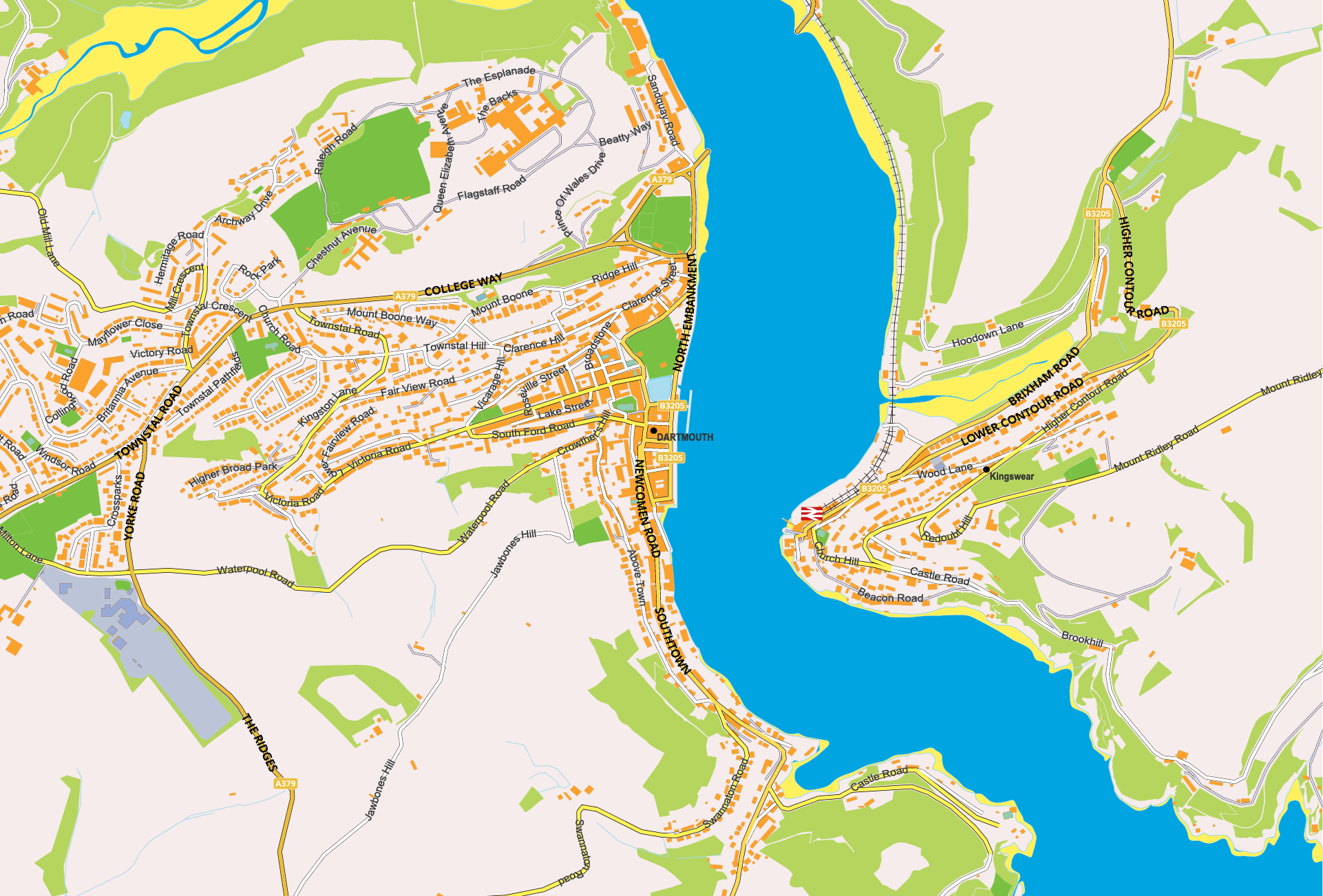
Dartmouth Castle and our historic churches are a delight to see, their origins dating back many hundreds of years. The Tour has been divided into two sections NORTH & SOUTH with the Dartmouth Boat Float being the Centrepoint.
Recommendations
To get the most from the tour, we recommend you choose either the North or South area and then follow the Places of Interest in the order we have set them out. By clicking on the place of interest next to the map, you will then be positioned on the right place within the page information. Under each POI you can select the return to map at any time.
The videos have been optimised for mobile device playback.
We hope you enjoy this interactive tour of Dartmouth.
South
13. South Embankment
14. Historic Lower Ferry
15. Bayards Cove
16. Bayards Fort
17. South Town
18. Warfleet
19. Dartmouth Castle
20. St.Petrox’s Church
21. Gallants Bower (Optional)
1. Royal Avenue Gardens
2. North Embankment
3. Coronation Park
4. Higher Ferry
5. Britannia Royal Naval College
6. Clarence Street
7. Brown Hill Steps
8. Foss Street
9. St.Saviour’s Church
10. The Boat Float
11. The Butterwalk
12. Dartmouth Museum
13. South Embankment
14. Historic Lower Ferry
15. Bayards Cove
16. Bayards Fort
17. South Town
18. Warfleet
19. Dartmouth Castle
20. St.Petrox’s Church
21. Gallants Bower
1. Royal Avenue Gardens

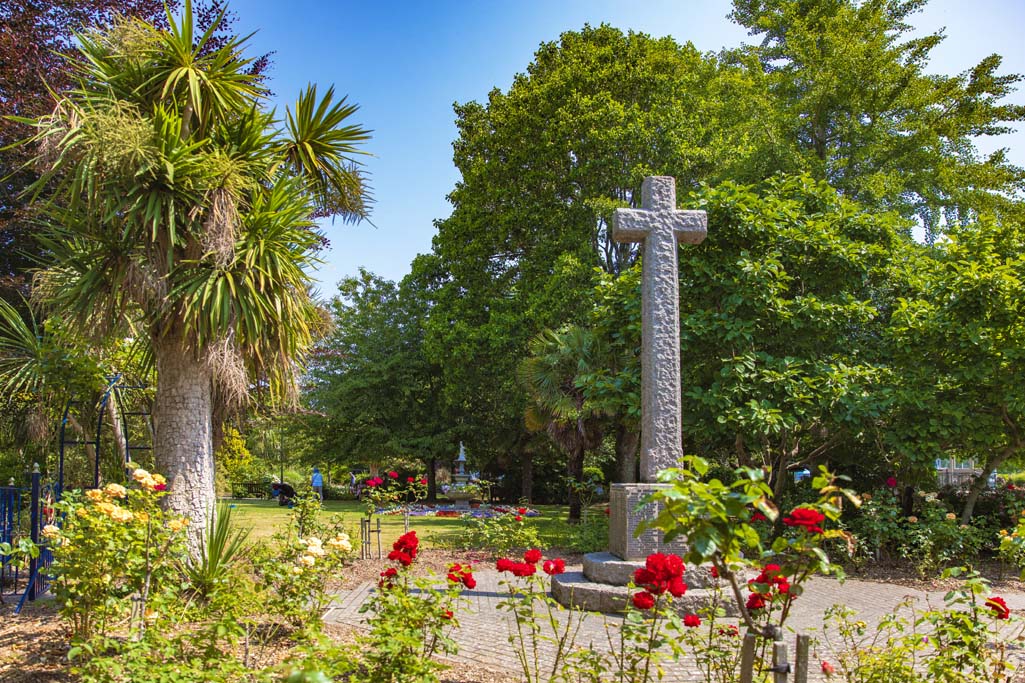
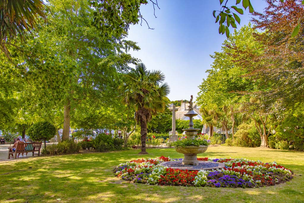
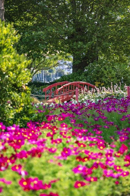
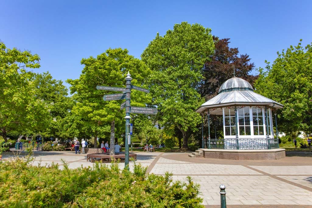
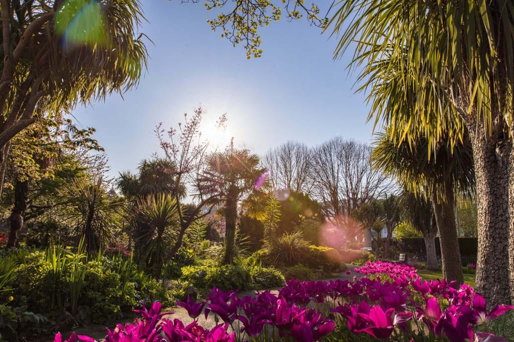
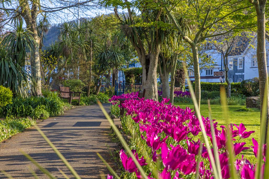
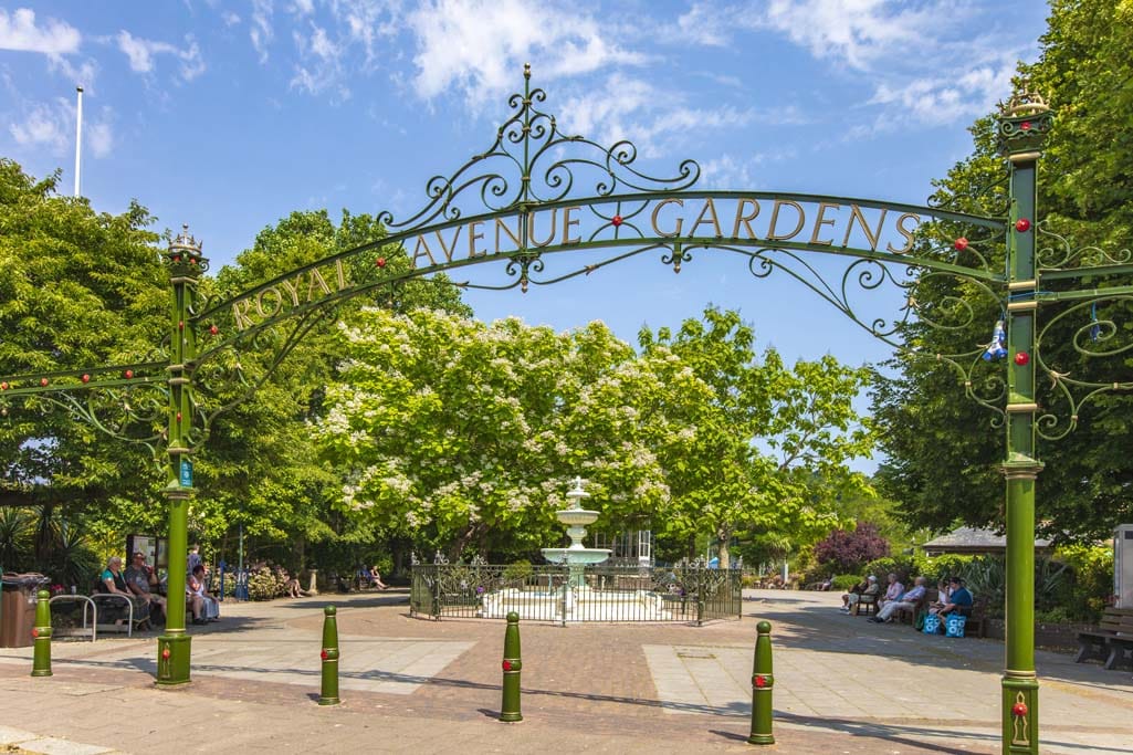
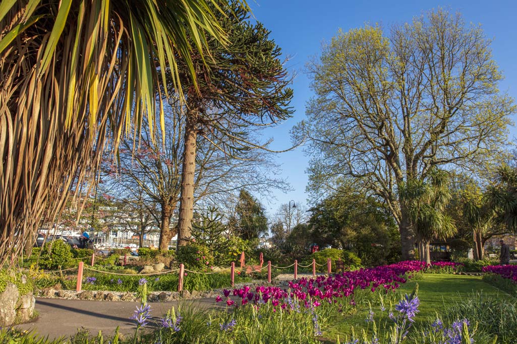
ROYAL AVENUE GARDENS
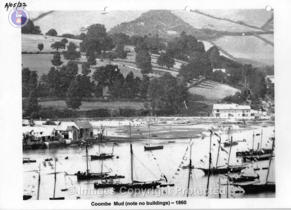
The area of land where the gardens now stand was once part of the river banks and mud flats and part of Dartmouth’s development during the 16th and 17th centuries. The land reclamation, was necessary to create both the North and South Embankment where visiting trading ships became larger and more frequent with International trade becoming an essential part of Dartmouth’s commercial development, making it a major port and with its natural deep water harbour and direct connection with the English Channel.
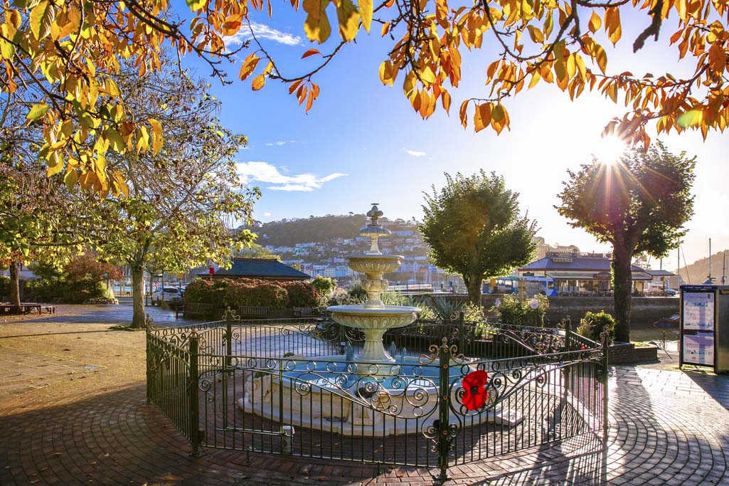
Royal Avenue Gardens was created by the Town Council and opened in 1887, named after Queen Victoria’s visit to the town a few years earlier. The park’s fountain was added in 1897 to celebrate Queen Victoria’s Golden Jubilee.
The fountain, designed by Sir Henry Paul Seale, was added in 1897 to commemorate Queen Victoria’s Golden Jubilee. This was later replaced by The Old Dartmothian’s, who maintain it to a beautifully high standard.
The gardens also feature a cast iron bandstand and a triple-tier structure, which contribute to the park’s picturesque townscape.
There is a War Memorial which is the focal point of Remembrance Day Services each year and which is attended by a large congregation of the towns dignitaries, The British Legion and members of the armed services.
The gardens are maintained by the town council to an exceptionally high standard and are enjoyed throughout the year by residents and the towns many visitors.
The Bandstand Summer Flowers & Decorative Bridge The Historic Bandstand Late Spring and looking beautiful Autumn and Remembrance Day Children having fun Dartmouth Sparkles at Christmas Royal Avenue Gardens Sparkle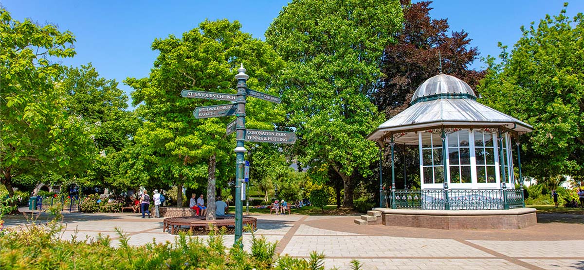
Royal Avenue Gardens
Dartmouth War Memorial
Royal Avenue Gardens
Royal Avenue Gardens
Royal Avenue Gardens
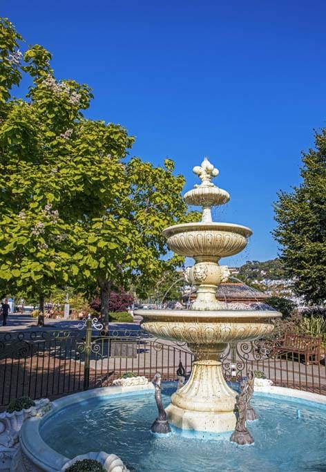
The Fountain – Royal Avenue Gardens
Royal Avenue Gardens

Royal Avenue Gardens

Royal Avenue Gardens
Royal Avenue Gardens
Royal Avenue Gardens
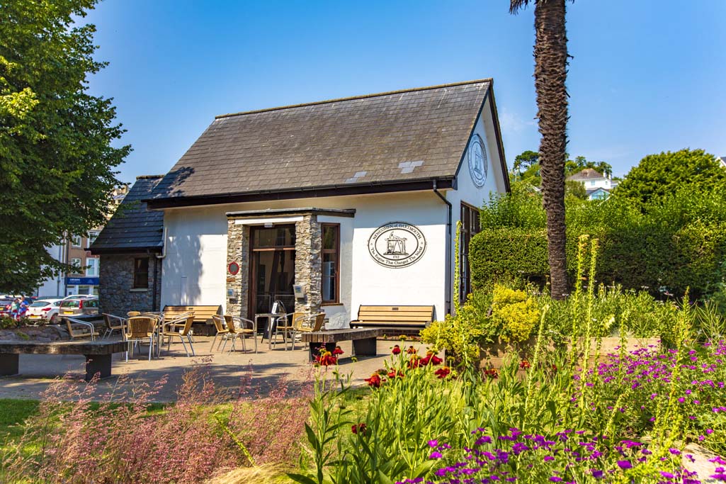
Dartmouth Visitor Centre
Royal Avenue Gardens
Royal Avenue Gardens
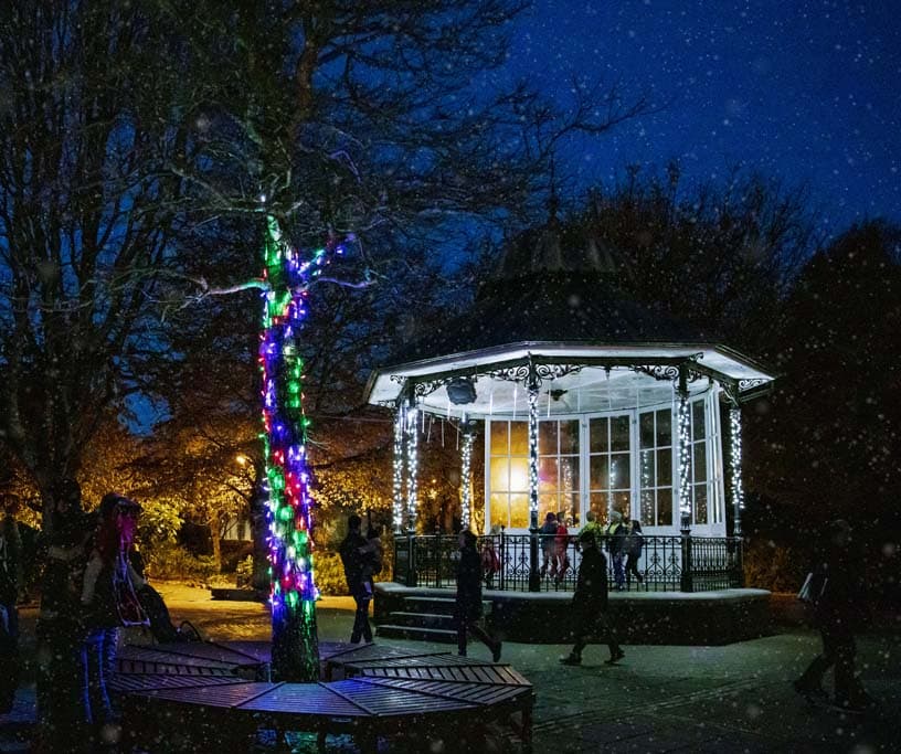
Christmas in Dartmouth
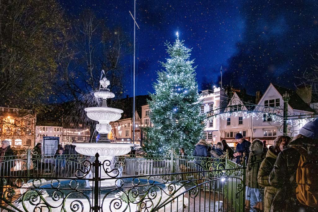
Candlelit Dartmouth
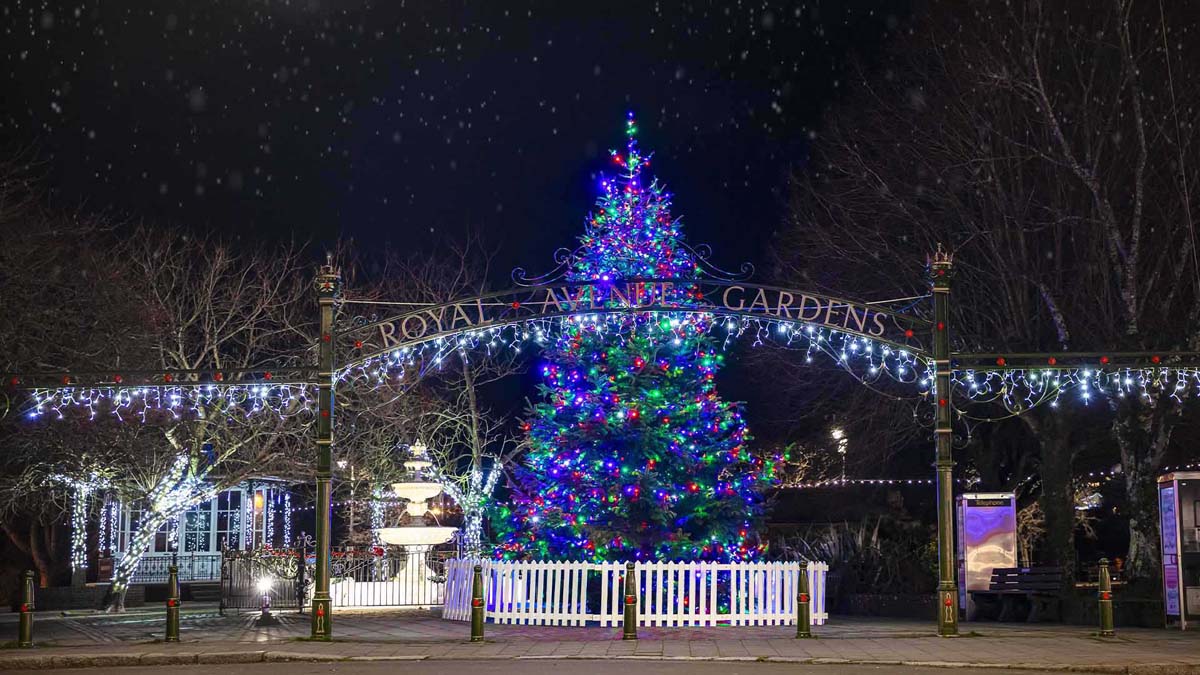
Christmas in Dartmouth
2. North Embankment

History of Land Reclaimation
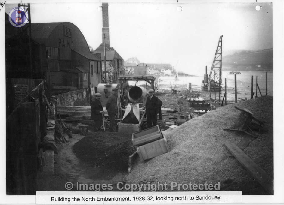
Land reclamation played a crucial role in the development of Dartmouth, particularly during the 16th and 17th centuries when it became a major trading port. Initially, Dartmouth was formed from two smaller settlements on opposite sides of a river, which were connected by a dam creating a mill pond. Over time, the mill pond silted up, and land reclamation projects began to expand the town’s usable area. Notable reclamation projects included filling in the mill pool in the 1800s to create more space for housing and a market square, and the construction of the North and South Embankments in the late 19th century.
Significant dates of the developments:
13th Century:
An earth dam, known as “La Fosse,” was constructed across the tidal creek to create a mill pond, according to the Dartmouth History Research Group.
1550-1640:
Land reclamation accelerated, particularly along the water’s edge, driven by the increasing imports of cloth, wine and fish.
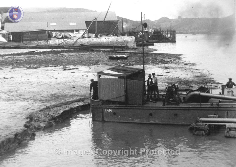
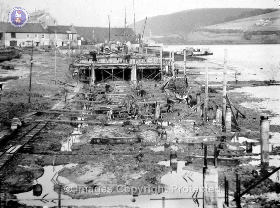
Aerial picture showing BRNC, Coronation Park and the North Embankment Dredging in preparation for the building of the North Embankment A favoured place to sit and relax and enjoy the views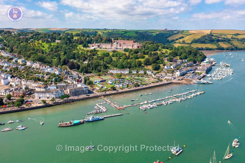
Dartmouth From The Air

Building The North Embankment Circa 1828
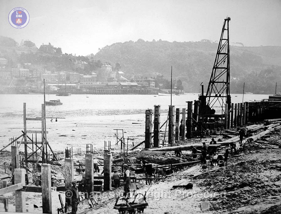
Building The North Embankment Circa 1884
Building The North Embankment Circa 1827
Building The North Embankment Circa 1827
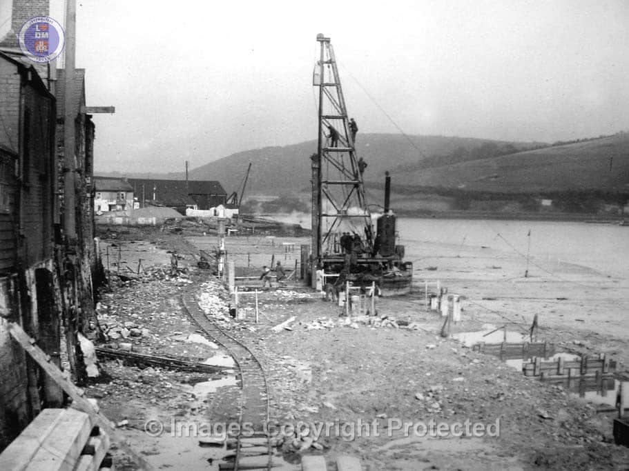
Building The North Embankment – Construction Well Underway
Building The North Embankment –
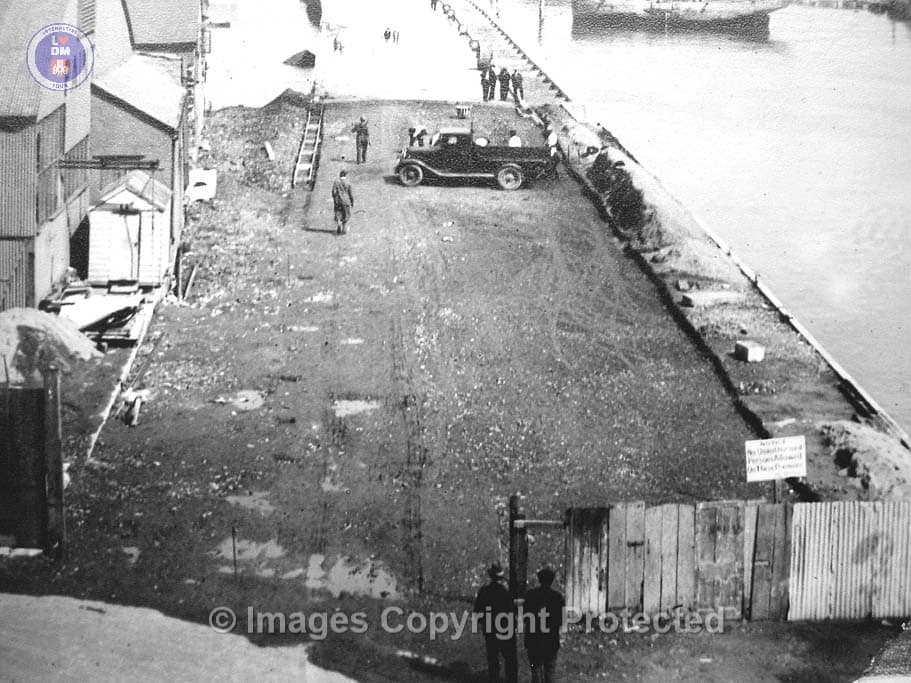
Building The North Embankment – Construction Well Underway
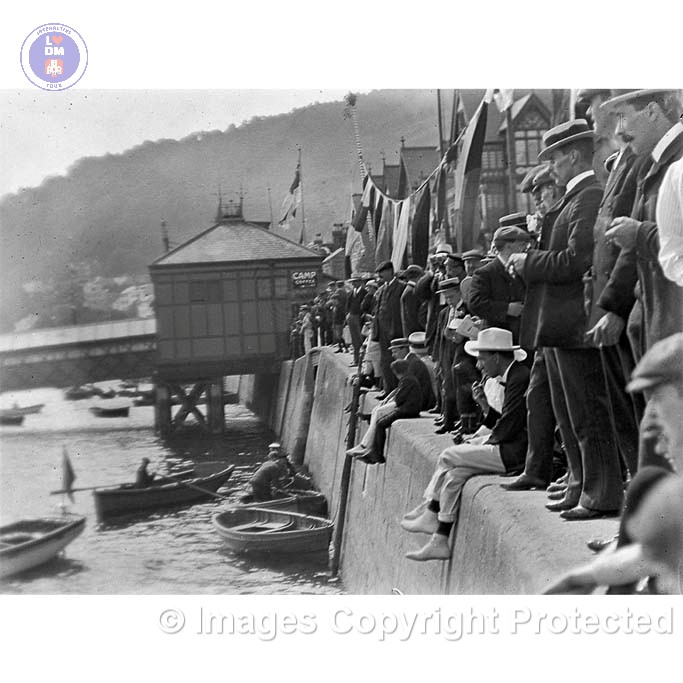
Regatta on the North Embankment
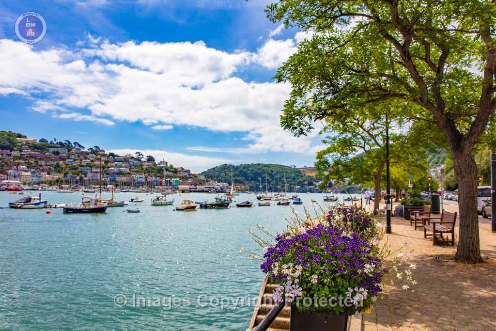
Embarking at the Quayside Steps – North Embankment
The North Embankment Today
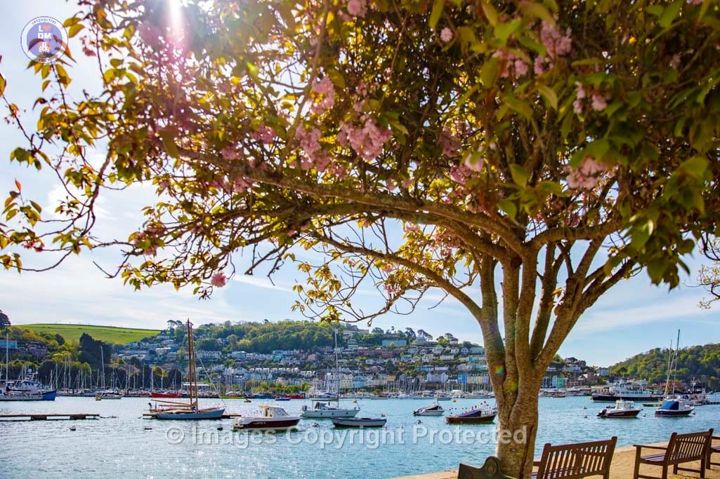
North Embankment
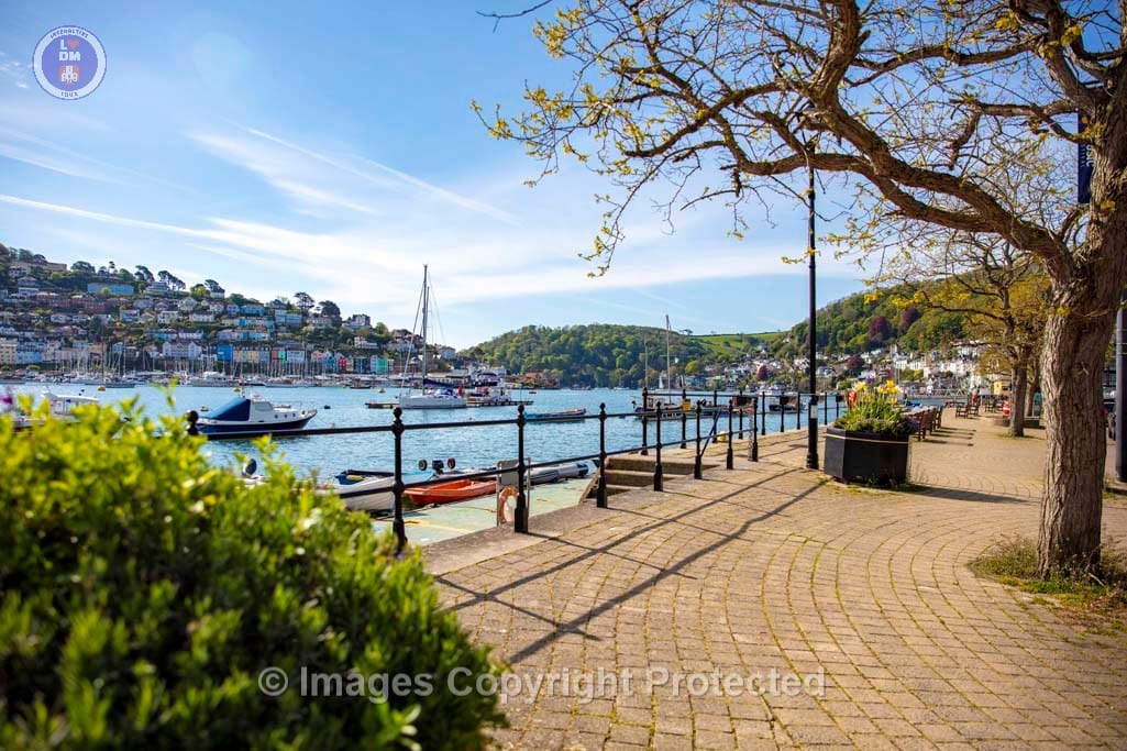
North Embankment
North Embankment
North Embankment
North Embankment

North Embankment Today
North Embankment
North Embankment
North Embankment Today
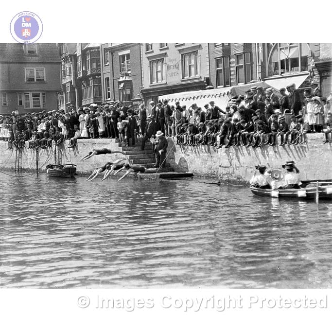
Swimming Event off Embankment
3. Coronation Park

CORONATION PARK
Coronation Park was created by reclaiming large areas of land along the banks of the river Dart in the 1930s, specifically to accommodate a larger waterfront. It was opened in 1937, marking the coronation of King George VI, according to the Dartmouth Town Council. The park was built on mudflats that were previously used for ship dumping and reclamation and there is the remains of a World War I submarine buried there.
The park was officially opened in 1937, coinciding with the coronation of King George VI, and it was initially named for Edward VIII before his abdication.
The park is a testament to Dartmouth’s maritime history, having been built on land previously used for shipyards and old warehouses.
Today the park is a welcome green space for residents and visitors, with a licensed Café on the South side and tennis courts, which are very popular.
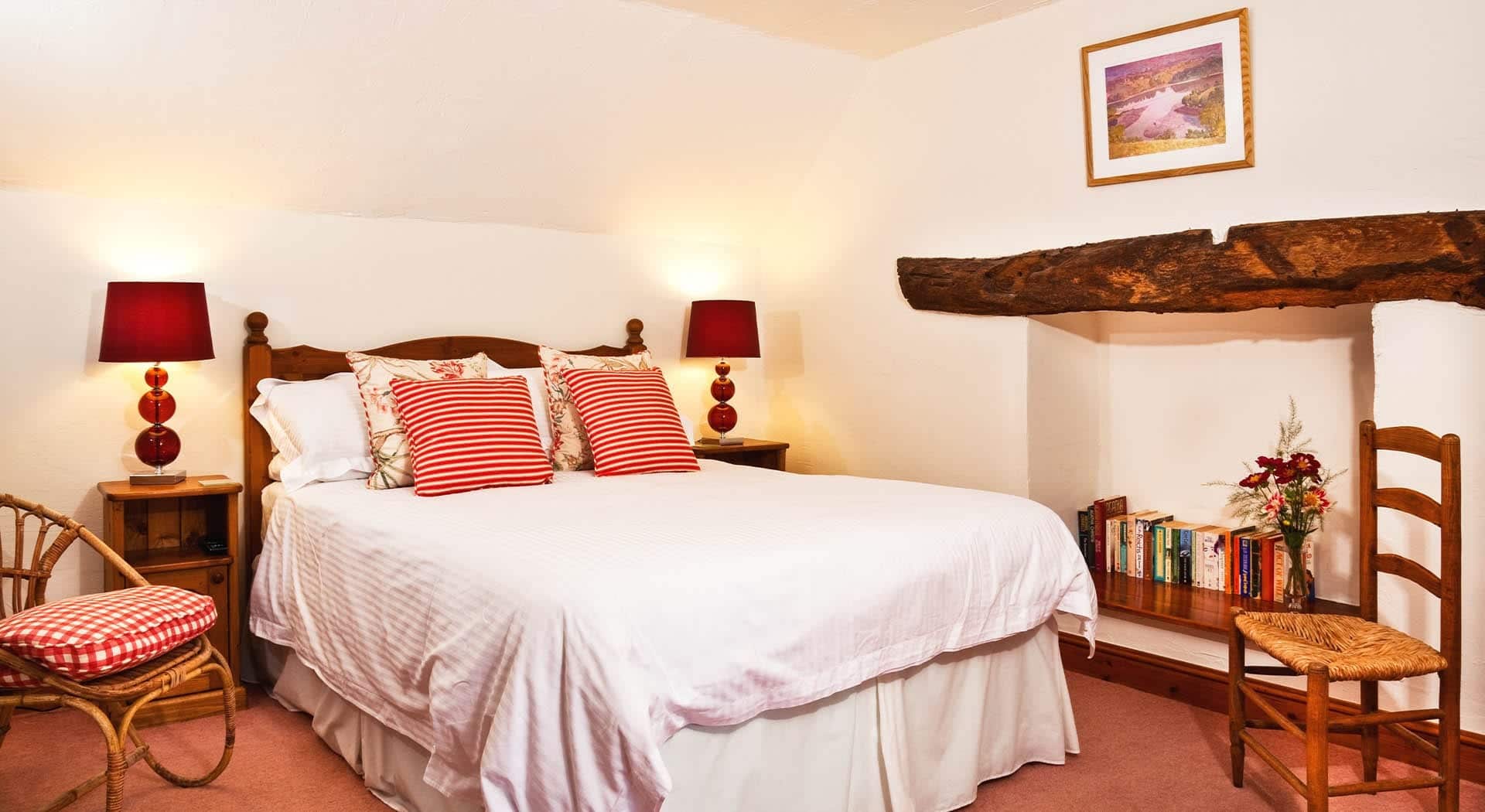
On the far side of the park on the South side, crossing the road is The Ship Inn Dock Inn, one of Dartmouth’s oldest pubs offering accommodation and near to Britannia Royal


4. Higher Ferry

HIGHER FERRY
The Higher Ferry, also known as The Floating Bridge, has a rich history, dating back to at least 1365 when there’s evidence of a ferry crossing the River Dart. In 1831, the “Floating Bridge” or Higher Ferry was officially opened, a technologically advanced platform propelled by chains across the river. It played a significant role in Dartmouth’s development during the 19th century.
The Higher Ferry is immediately adjacent to the Britannia Crossing, a level crossing across the Paignton and Dartmouth Steam Railway. All vehicles entering or leaving the ferry must cross this railway crossing.
Key Development Dates:
Pre-1800s: A ferry was mentioned in the area as early as 1365.
1828: James Meadows Rendel and John Foulston designed a suspension bridge for the river, but it was abandoned in favour of a ferry or floating bridge.
1831: The Dartmouth Higher Ferry (also known as the “Floating Bridge”) opened with great ceremony.
1855: The ferry was briefly suspended due to financial losses, but was reinstated the following year.
1855-1867: Initially steam-powered, it then operated with manual labour or horses.
1867: Steam power was reintroduced to operate the ferry.
1872-1874: The railway took over operation of the ferry.
1874: The ferry was closed again.
1876: The ferry reopened with a new design.
2005: A severe weather event caused the ferry to drifted away from its secure mooring, but crew managed to moor it safely.
2009: A new Dartmouth Higher Ferry was completed.
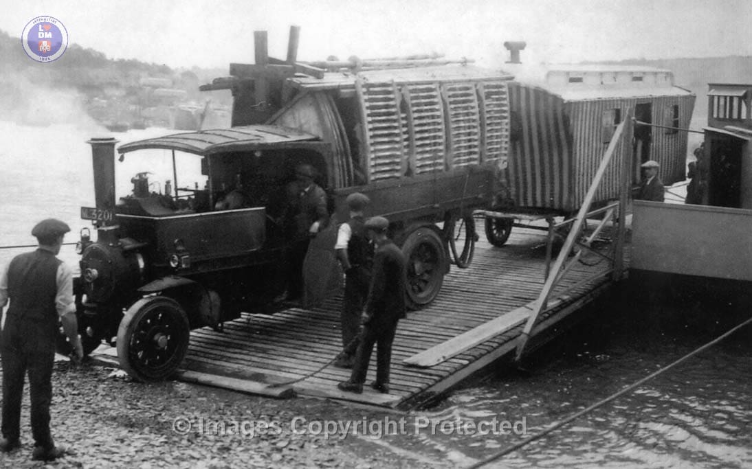
Higher Ferry with Steam Driven Vehicles Disembarking
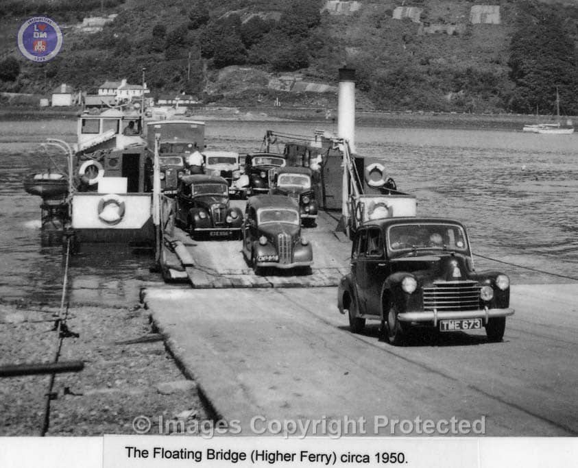
Early Cable Driven Higher Ferry – Circa 1957
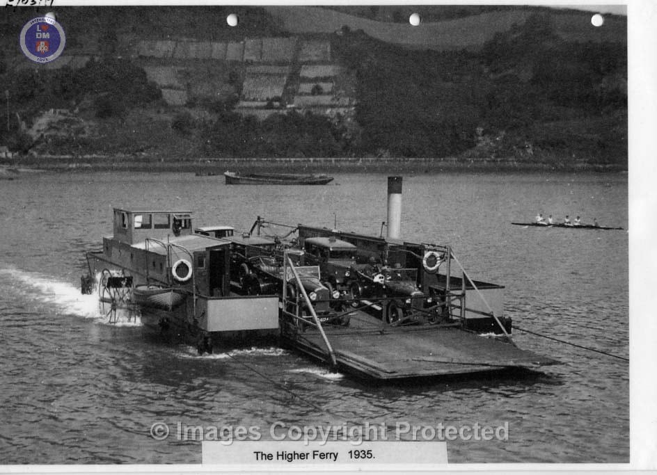
Higher Ferry – Circa 1935
5. Britannia Royal Naval College

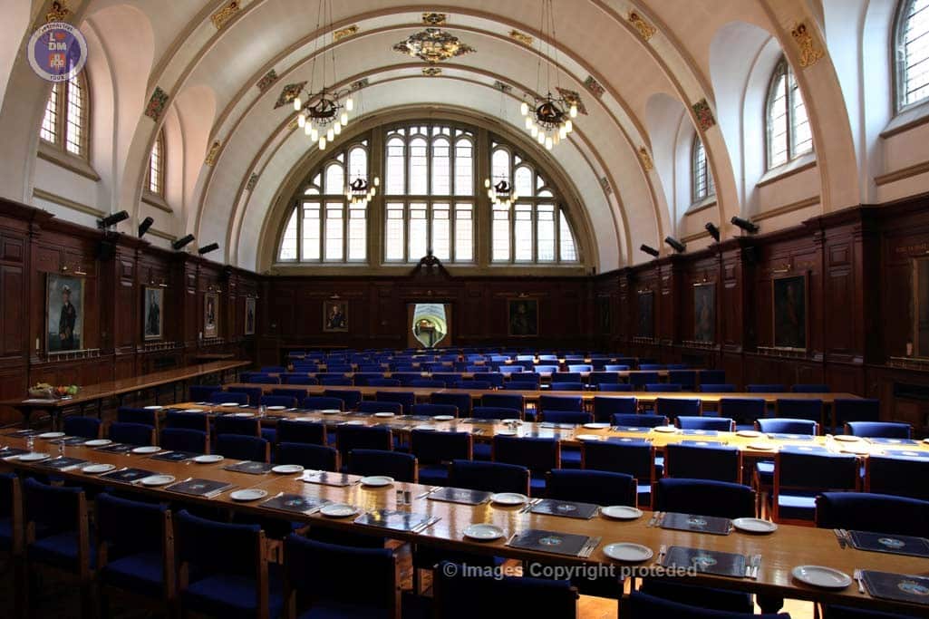
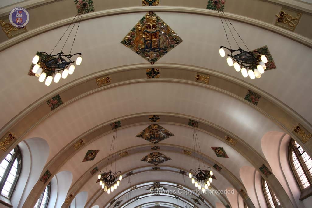
Britannia Royal Naval College traces its origins back to 1863, when the HMS Britannia was moored in the River Dart to train naval officers. Plans were drawn up in 1900 for a shore based college, designed by Sir Aston Webb, with the foundation stone for a new building at the college laid by King Edward VII in March 1902.
The college was officially opened in 1905, with the first intake of cadets joining in September that same year.
Key Events in BRNC Timeline
1863: HMS Britannia, a former ship, is moored in the River Dart to serve as a training vessel for naval cadets.
1865: HMS Hindostan joins HMS Britannia as a training hulk.
1898: Foundations are laid for a shore-based college, recognizing the limitations of training on ships.
1902: King Edward VII lays the foundation stone for the new building, designed by Sir Aston Webb.
1905: Britannia Royal Naval College officially opens with the first cadets entering.
1939: HM Queen Elizabeth met Prince Philip at the Royal Naval College in Dartmouth, where Philip was a cadet.
1942: The college is evacuated and temporarily closed due to bombing during World War II.
1946: The college reopens with expanded courses.
1971: HRH The Prince of Wales joins as a graduate Sub Lieutenant.
1990: Integration of female Naval Officers’ training with male counterparts.
The college was originally known as the Royal Naval College, Dartmouth (RNC). As a Royal Naval shore establishment, it was later known also by the ship name HMS Britannia (a battleship called Britannia operated from 1904 to 1918). The college was renamed HMS Dartmouth in 1953, when the name Britannia was given to the newly launched royal yacht HMY Britannia. The training ship moored in the River Dart at Sandquay, a Sandown class minehunter formerly known as HMS Cromer, continues to bear the name Hindostan.
Tours are available here: https://britanniaassociation.org.uk/britannia_guided_tours/
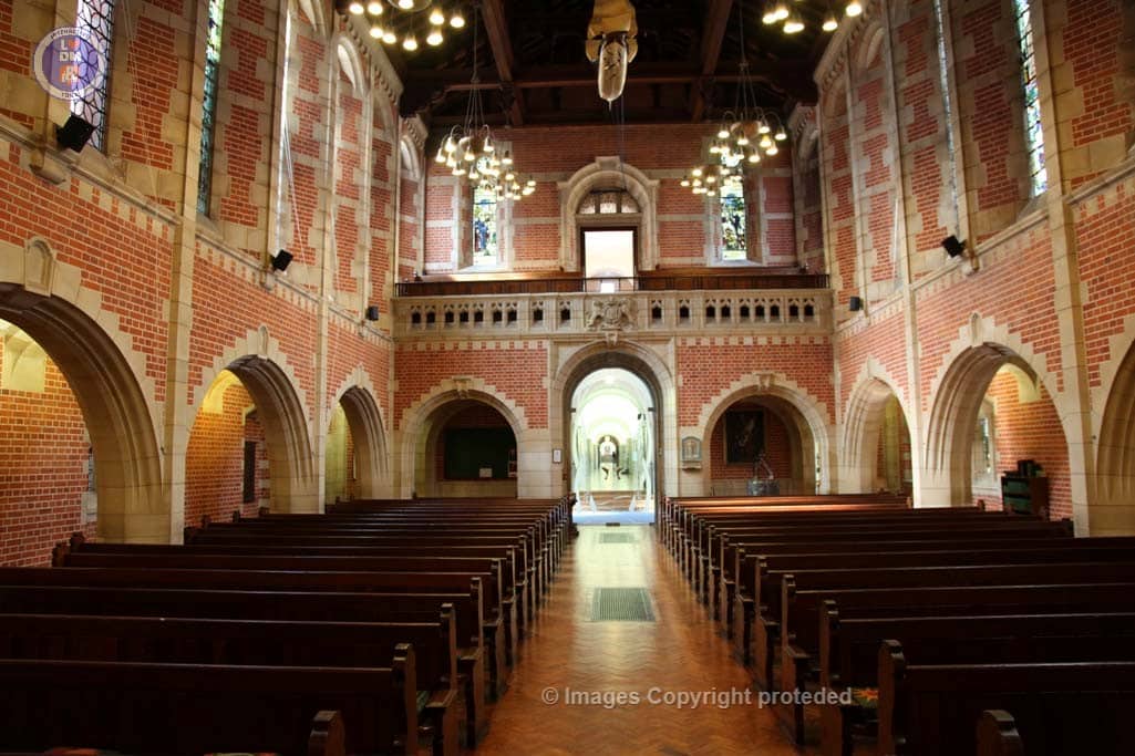
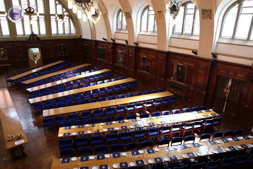
Designed by Sir Aston Webb – Red Brick & Bath Stone Made by a Napoleonic prisoner of war Many mess dinners served here and overlooked by paintings of distinguished senior officers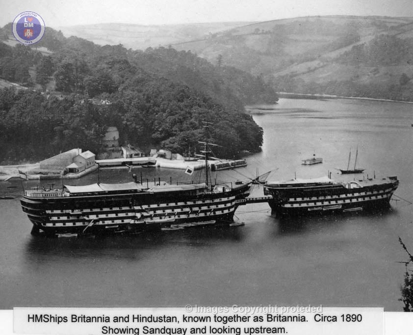
HMS Britannia and Hindustan – Circa 1890
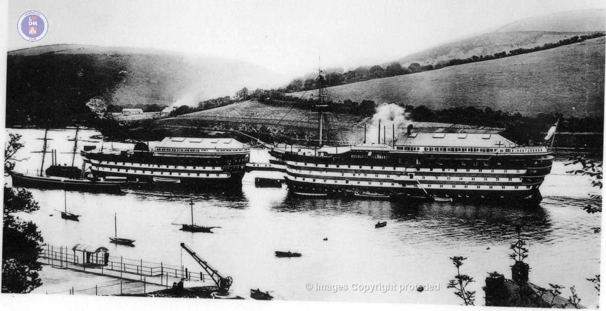
HMS Britannia and Hindustan – Circa 1890
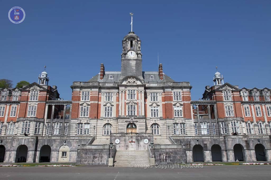
Britannia Royal Naval College
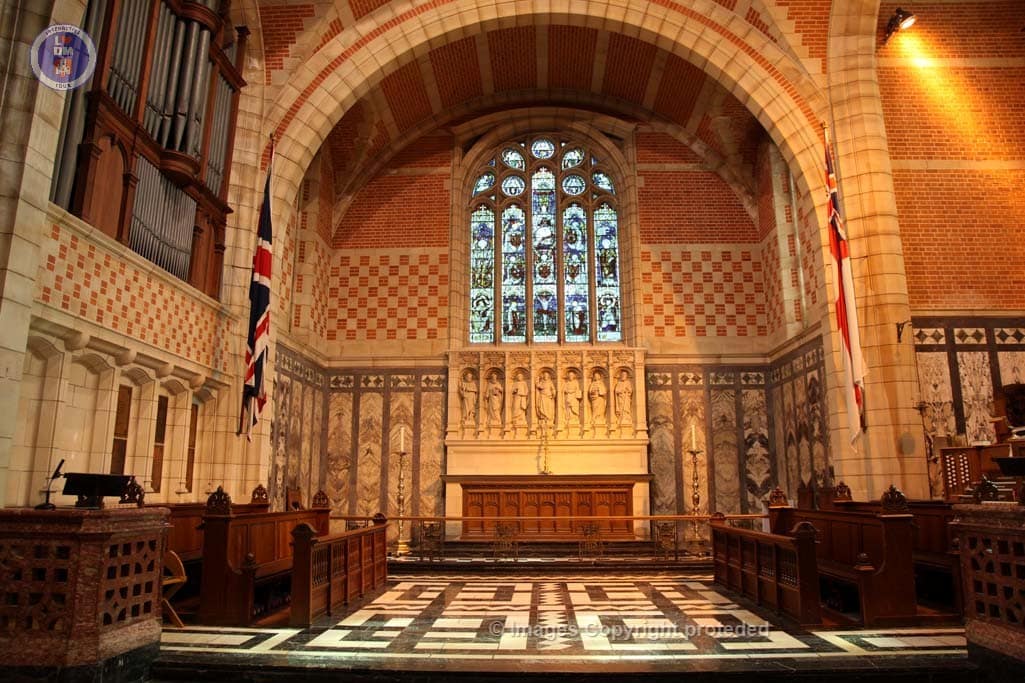
The Chapel Altar
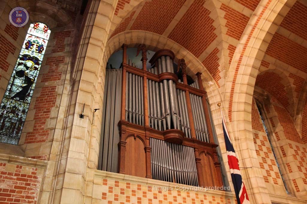
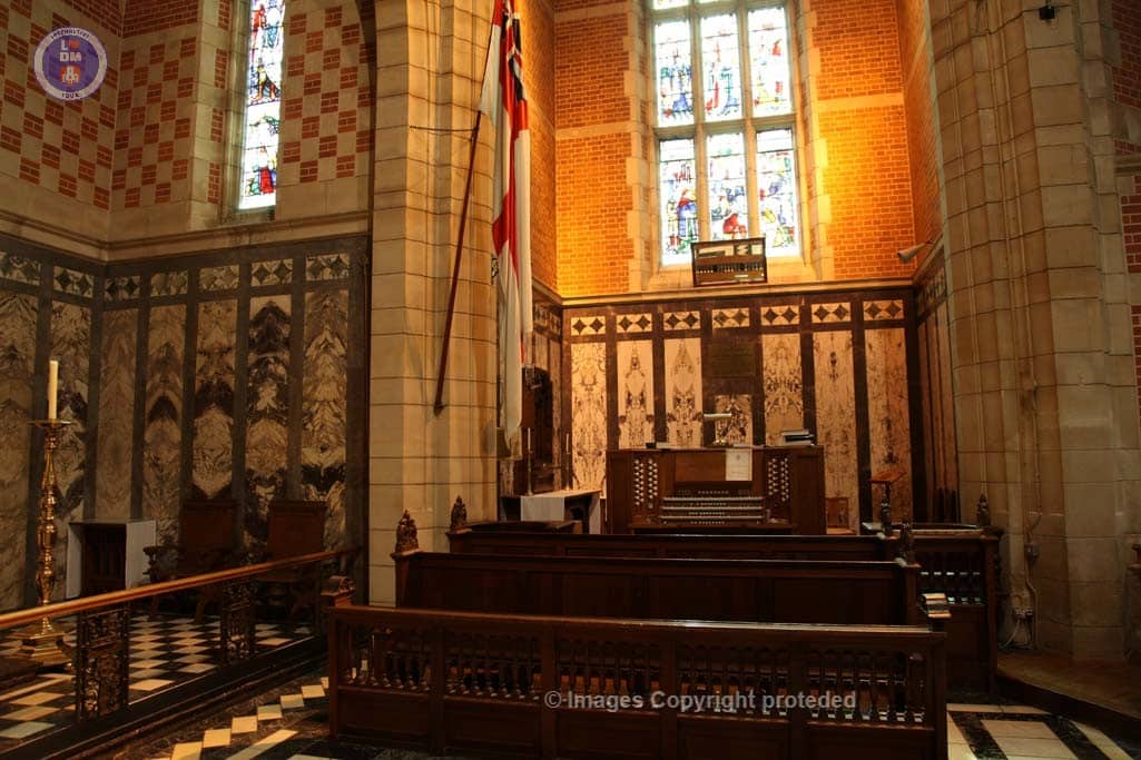
The Chapel Organ
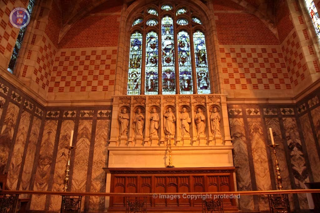
Above the altar
The Altar in the chapel
The Chapel BRNC
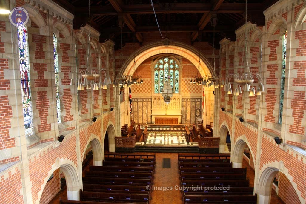
The Beautiful Chapel
The Chapel BRNC
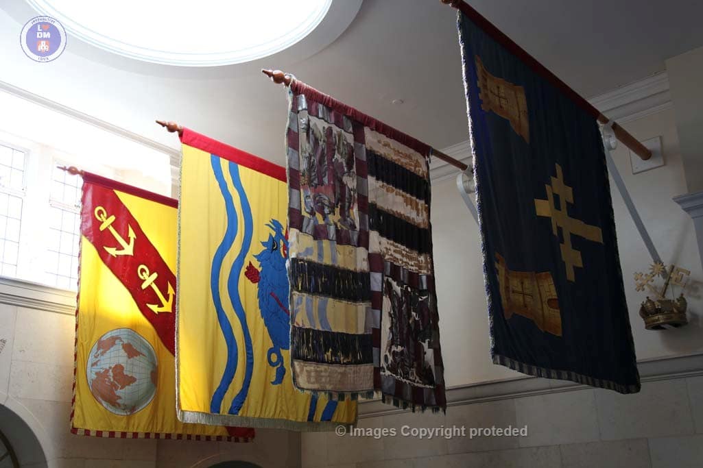
Banners of Knights of the Bath.
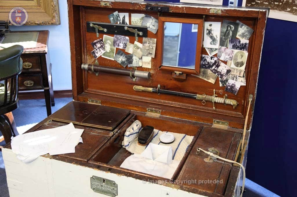
Cadet Sea Chest – Circa 1910
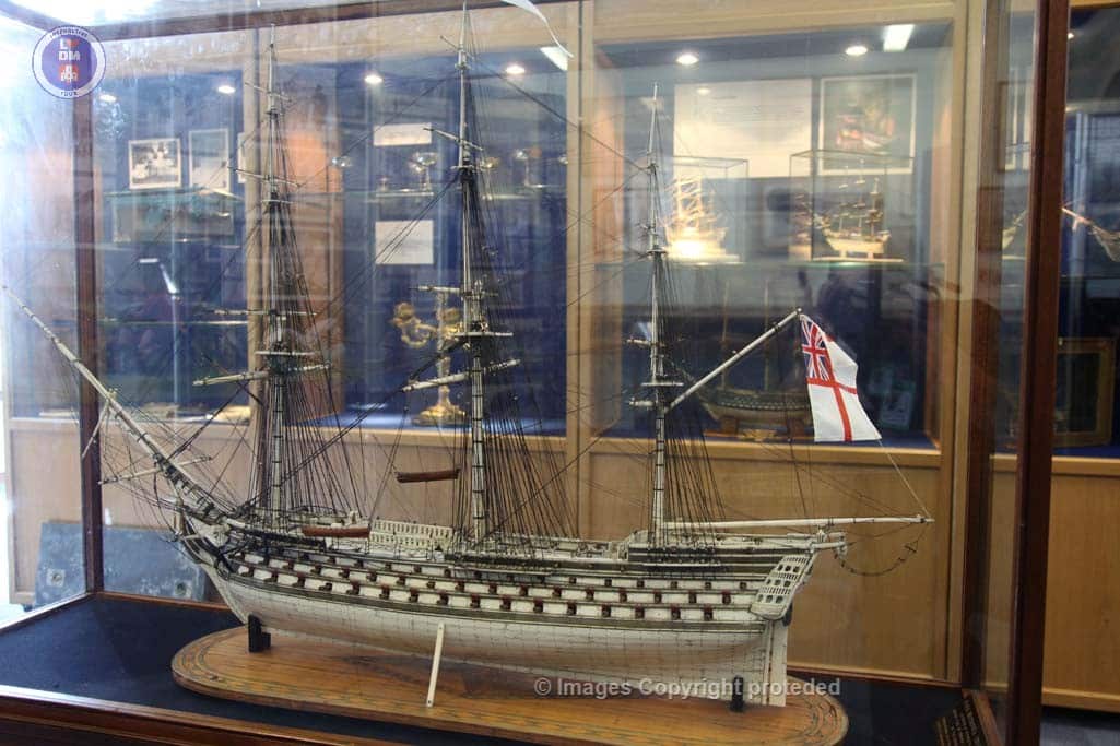
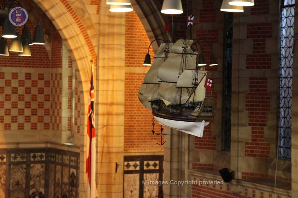
Bone Model of Britannia
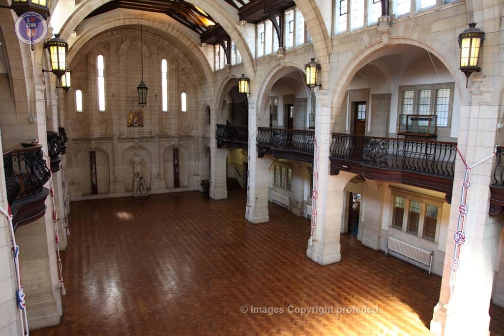
Britannia Royal Naval College Quarter Deck
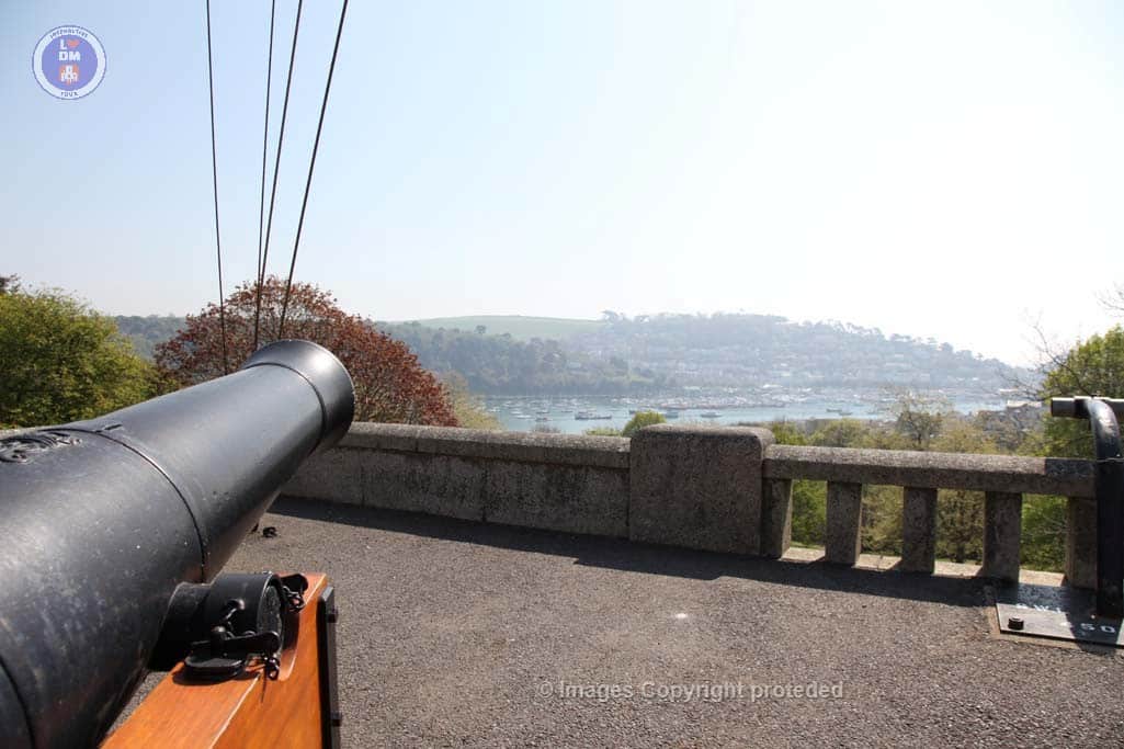
BRNC Canon
BRNC Senior Gun Room
BRNC Senior Gun Room
BRNC
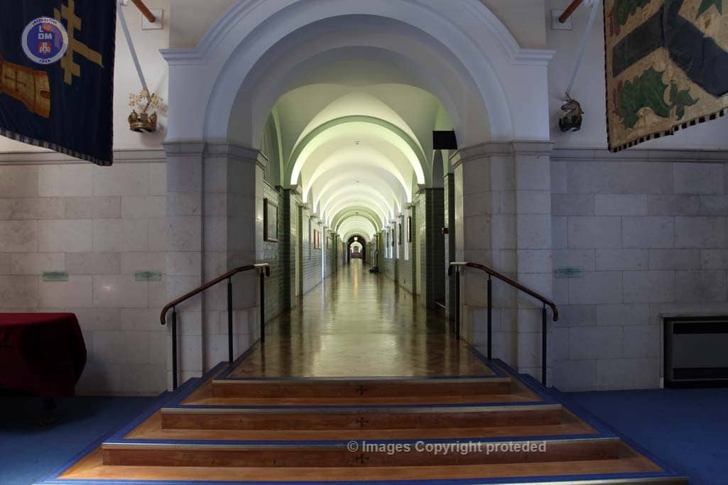
BRNC Long Corridoor
6. Clarence Street

Lorem ipsum dolor sit amet, consectetur adipiscing elit, sed do eiusmod tempor incididunt ut labore et dolore magna aliqua. Ut enim ad minim veniam, quis nostrud exercitation ullamco laboris nisi ut aliquip ex ea commodo consequat. Duis aute irure dolor in reprehenderit in voluptate velit esse cillum dolore eu fugiat nulla pariatur. Excepteur sint occaecat cupidatat non proident, sunt in culpa qui officia deserunt mollit anim id est laborum
Lorem ipsum dolor sit amet, consectetur adipiscing elit, sed do eiusmod tempor incididunt ut labore et dolore magna aliqua. Ut enim ad minim veniam, quis nostrud exercitation ullamco laboris nisi ut aliquip ex ea commodo consequat. Duis aute irure dolor in reprehenderit in voluptate velit esse cillum dolore eu fugiat nulla pariatur. Excepteur sint occaecat cupidatat non proident, sunt in culpa qui officia deserunt mollit anim id est laborum
7. Brown Hill Steps

BROWNS HILL STEPS
Brown’s Hill Steps are represent extremely significant importance to ancient routes in an out of Dartmouth. This narrow path served as the main packhorse route carrying goods from ships and supplies into town long before wheeled traffic roads were built. The stepped lane and attractive cottages along its route provided access to the parish church of St Clement’s and other areas outside the town, including the shipyards at Hardness.
8. Foss Street

Foss Street traces the route of a medieval dyke that once dammed a tidal creek and housed a tidal mill. This dyke, known as “La Fosse” or “The Foss,” and was constructed around 1243. Later in 1286, the area was being used for a tidal mill which used the flow of water from the pool to power its paddles and pulleys. The mill pool was eventually filled in, with development beginning on reclaimed ground, including the construction of many of the houses and buildings that line Foss Street today.
Foss Street today, is a colourful and popular shopping area, with a wide variety of art, clothing, unusual gifts and is highly favoured by photographers for its picturesque beauty.
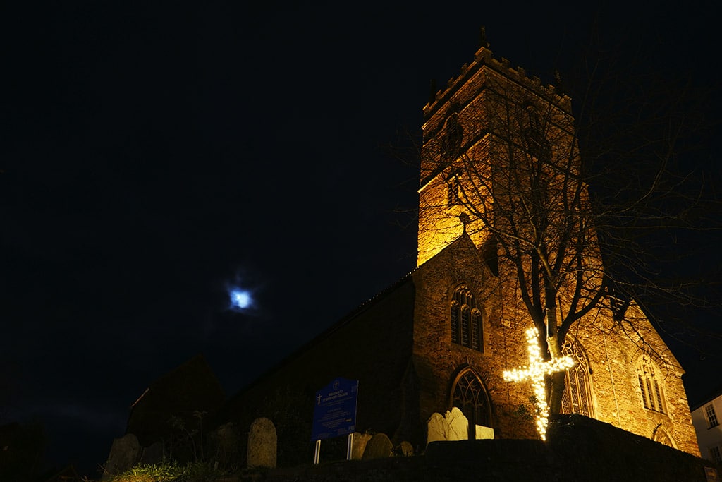
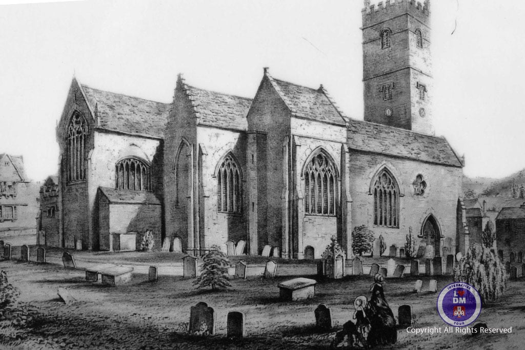
9. St.Saviour’s Church

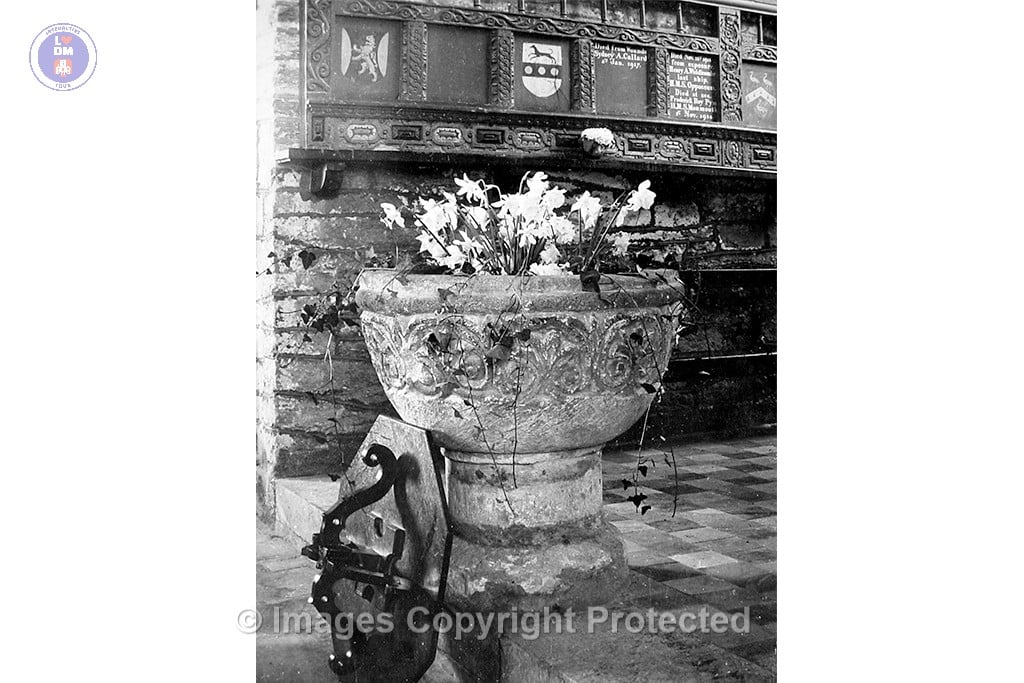
St. Saviour’s Church has a rich history, beginning as a chapel of ease under St. Clement’s Church and dedicated in 1372. It was built to serve the developing town near the river, as parishioners initially struggled to reach the parish church of St. Clement across a ford and up a hill. The church underwent several renovations and additions throughout the centuries, including a major refurbishment in the 17th century and a comprehensive restoration in the late 19th century.
Between 1633-1637, a major refurbishment of the church took place, including the heightening of the tower, the addition of new windows, and the erection of a gallery.
Later in the late 19th Century, a major restoration in two phases saw the church reroofed, the chancel stripped of its furnishings, the organ enlarged, and a vestry built.
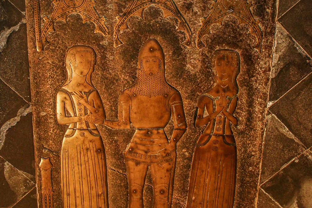
The church features a south door with medieval ironwork, a font believed to be very ancient, and memorial brass to John Hawley, a shipowner and mayor of Dartmouth.
NOT YET COMPLETE
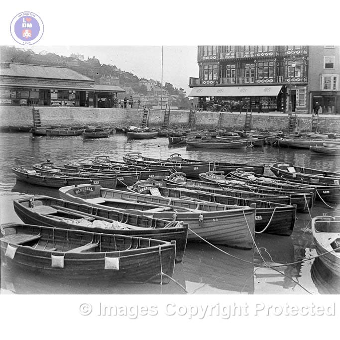
10. The Boat Float

THE BOAT FLOAT
The Boat Float in Dartmouth is a small tidal enclosure for mooring small boats, which dates back 1585 and where other major works were carried out by engineer WN Bidder around 1889, when the South Embankment was completed in 1889, leaving an area of the River Dart isolated and which became the Boat Float, accessible only to smaller vessels through a bridge under the road.
The Boat Float is Grade 2 listed and recognized for its historical and architectural significance.
Today is a focal point for visitors to enjoy with the Royal Castle Hotel situated behind.
Boatfloat facing Platform 1 Old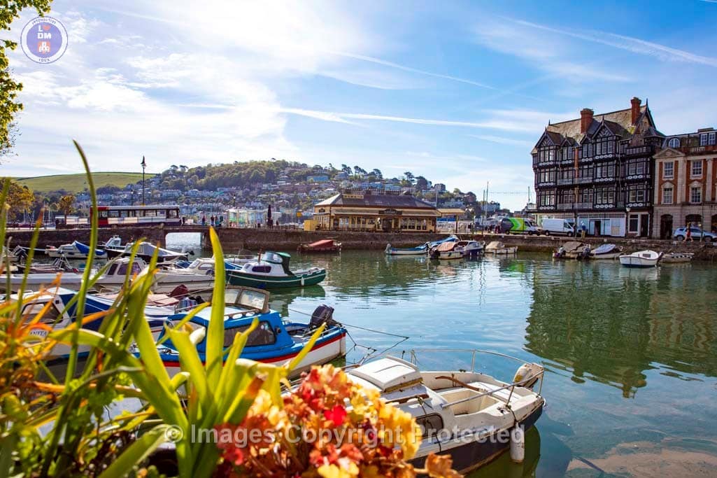
Dartmouth Boatfloat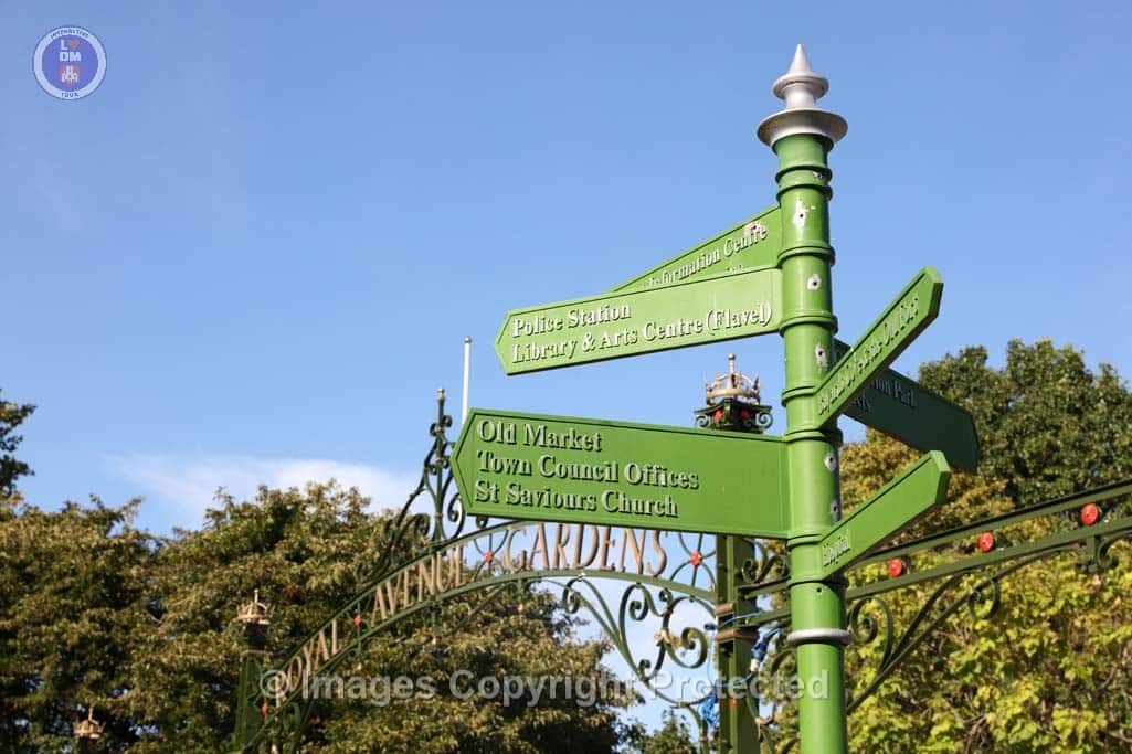
Town Direction Signpost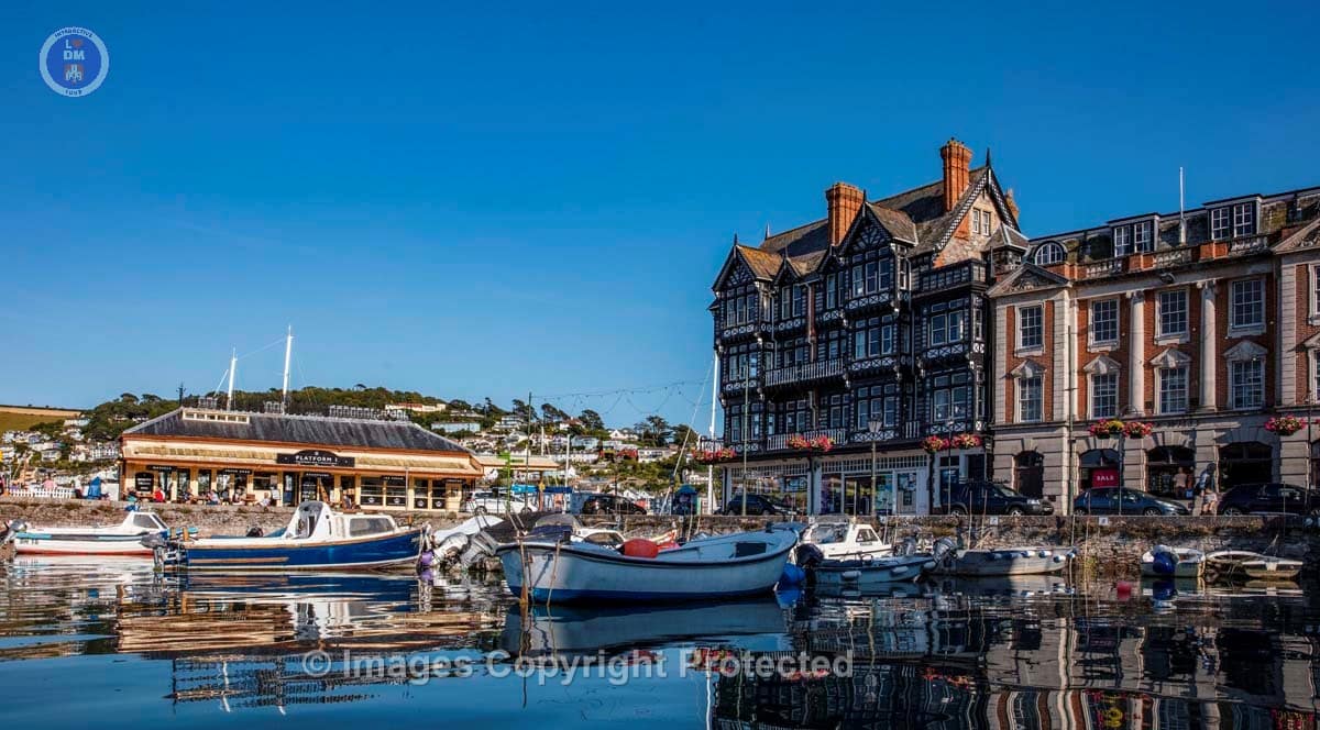
Dartmouth Boatfloat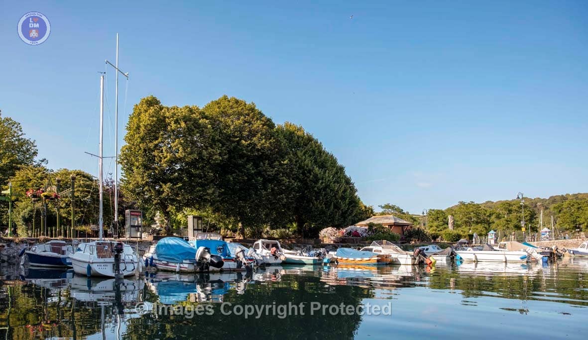
Dartmouth Boatfloat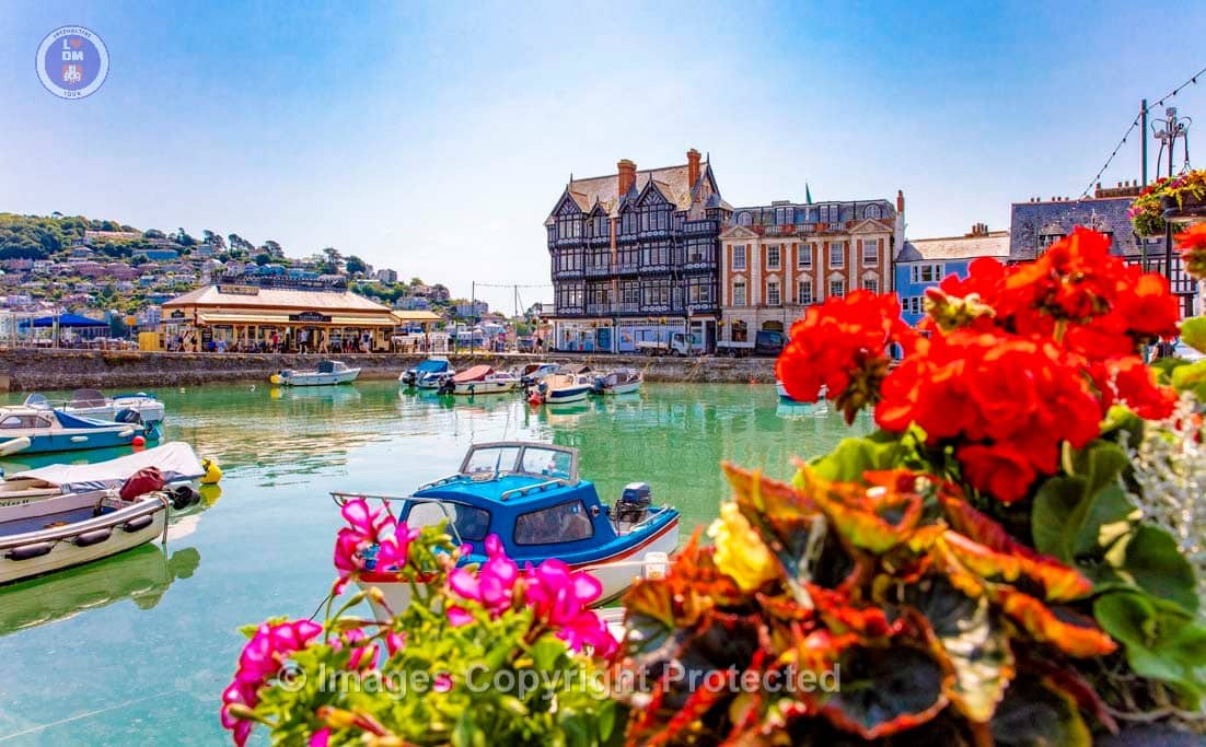
0J7A4079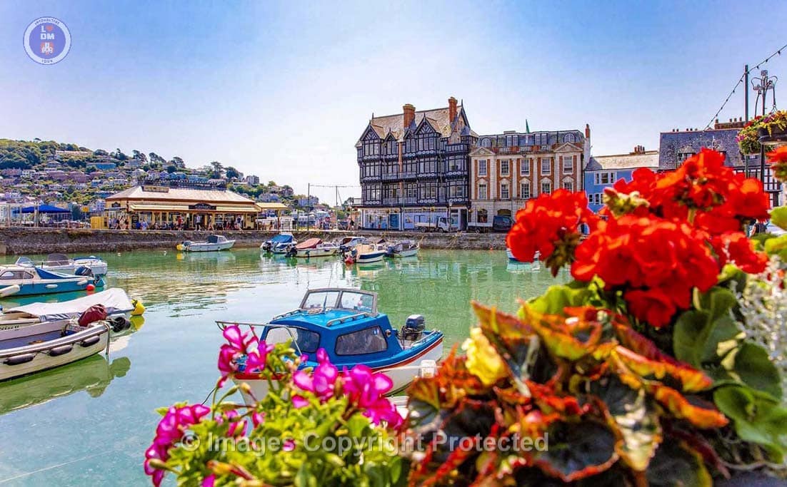
Dartmouth Boatfloat & Summer Flowers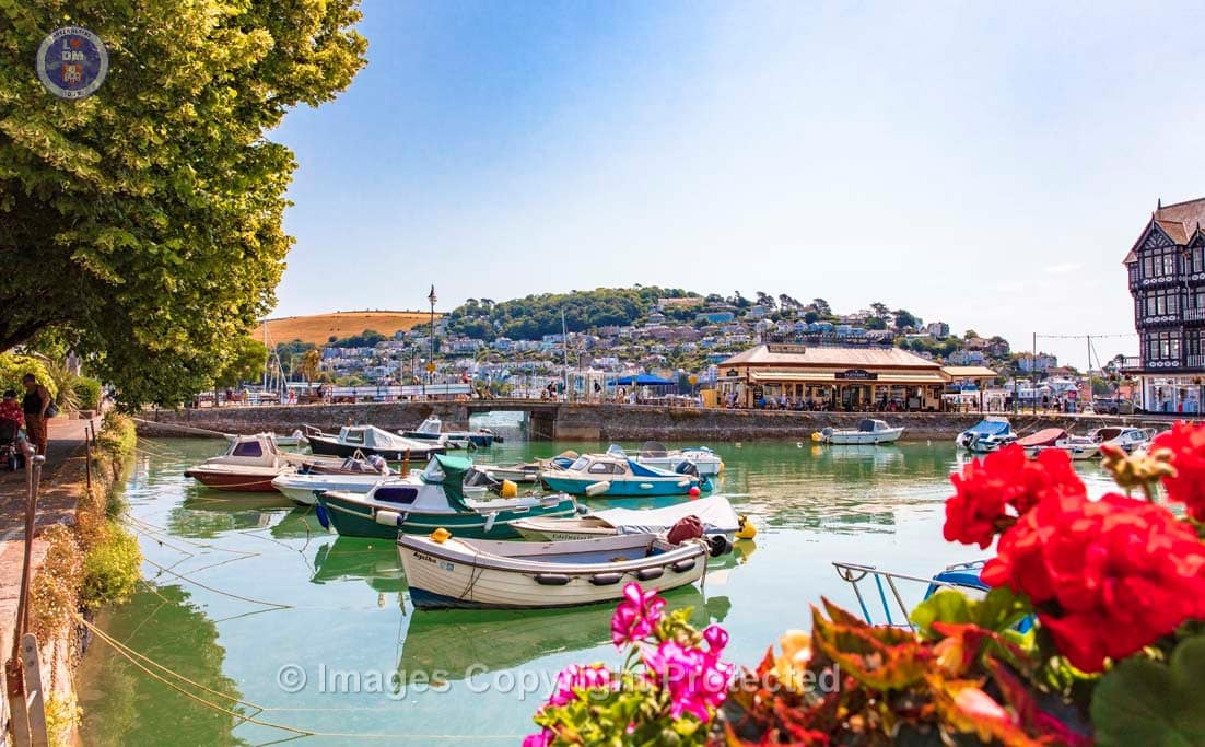
Dartmouth Boatfloat & Summer Flowers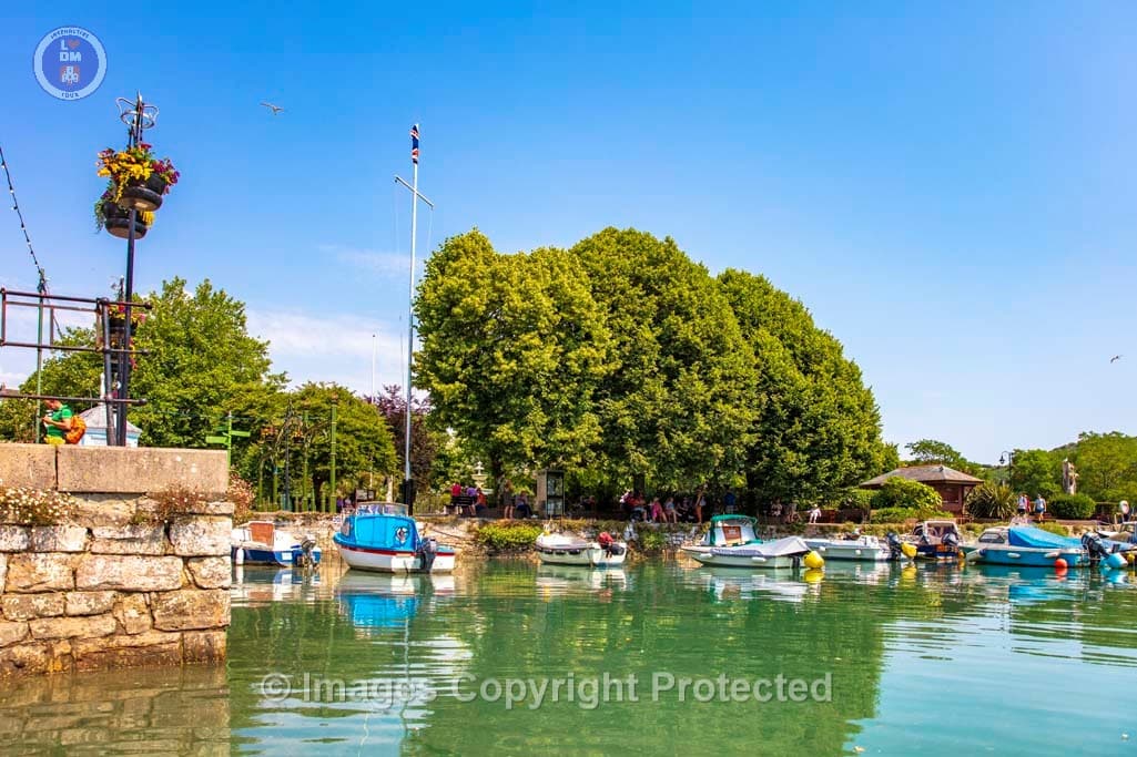
Dartmouth Boatfloat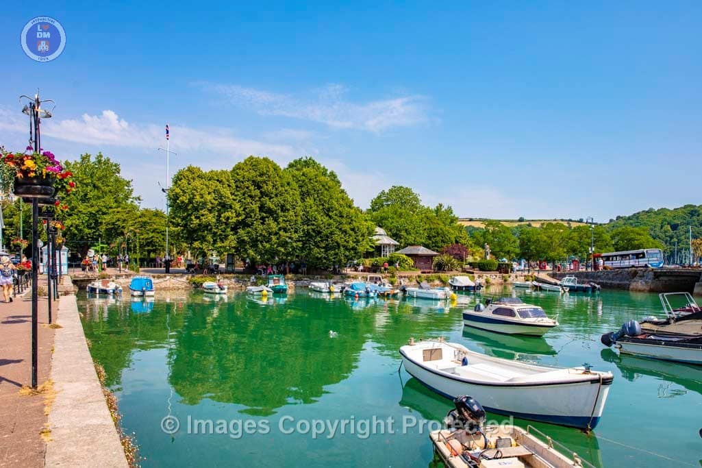
Dartmouth Boatfloat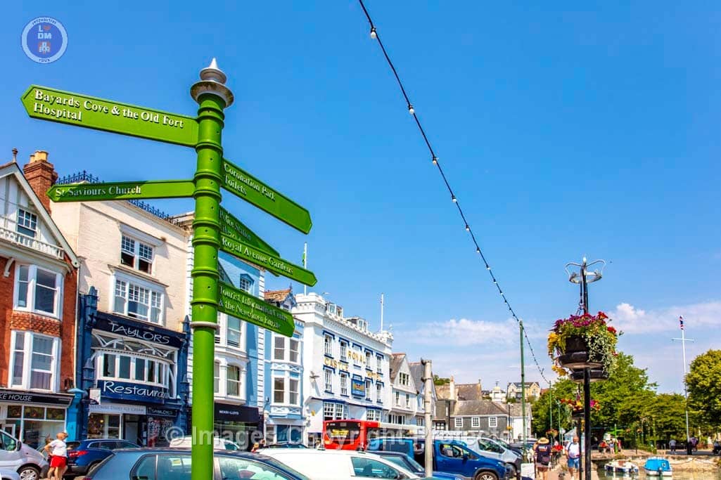
Town Sign on the corner of the Dartmouth Boatfloat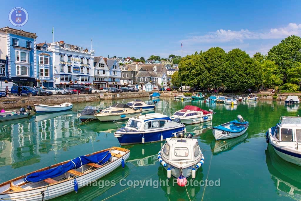
Dartmouth Boatfloat in Summer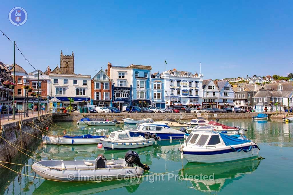
Dartmouth Boatfloat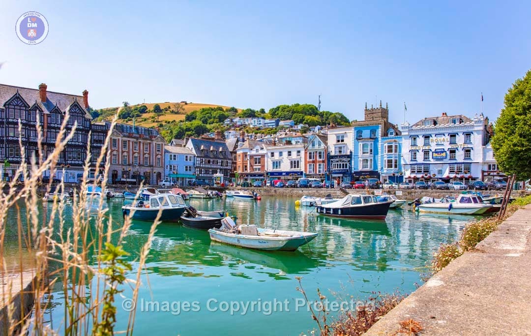
Dartmouth Boatfloat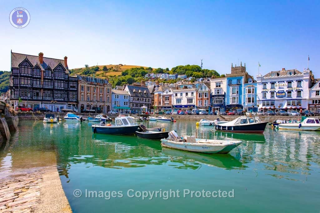
Dartmouth Boatfloat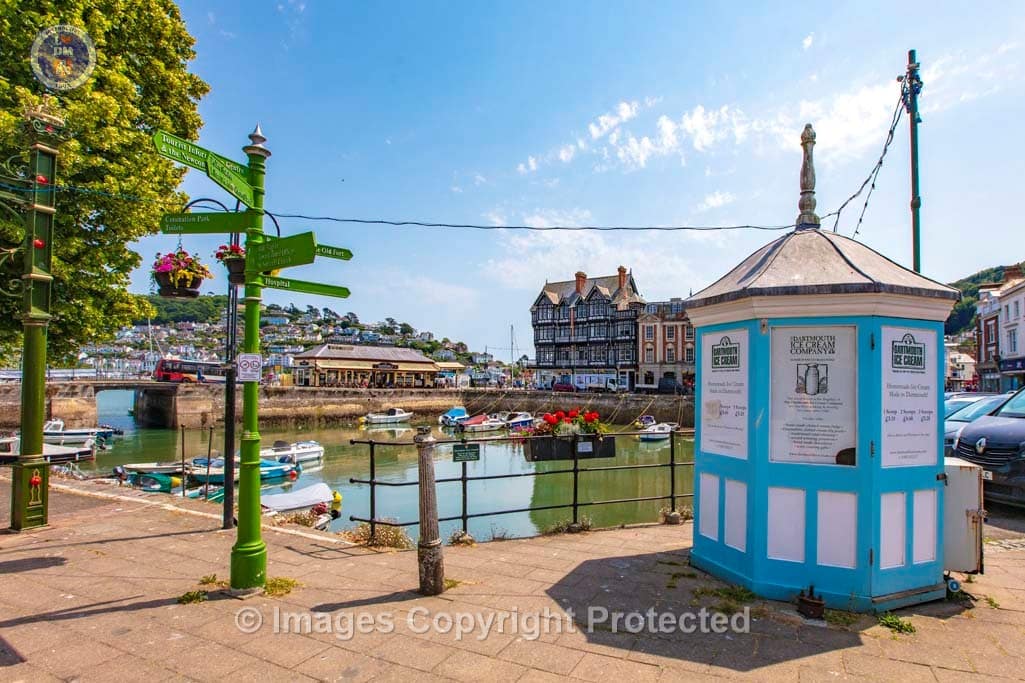
View across Dartmouth Boatfloat in Summer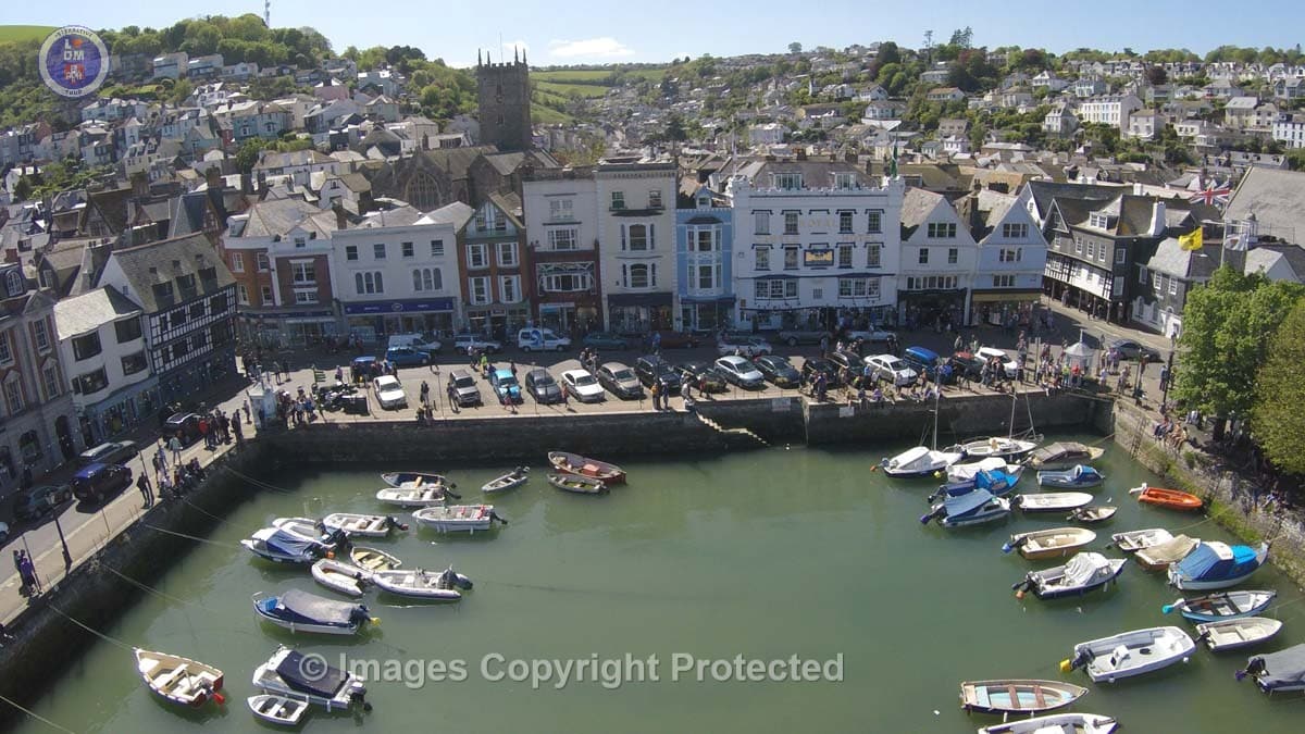
Dartmouth Boatfloat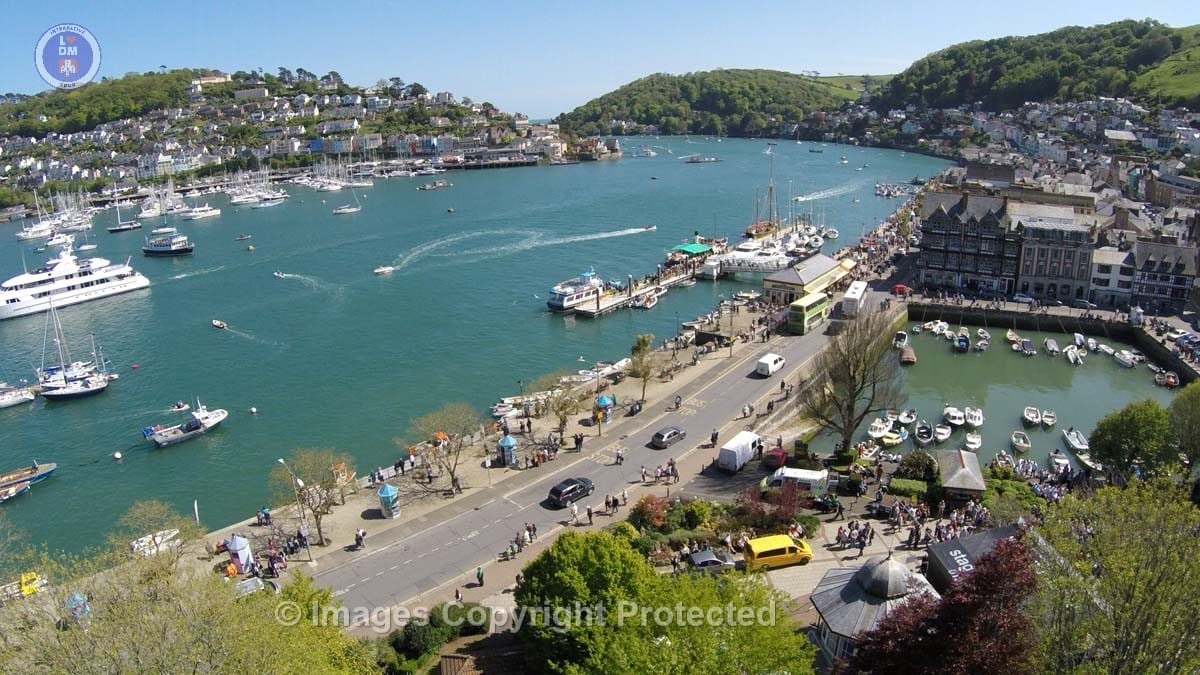
Aerial View of Dartmouth Boatfloat and the river Dart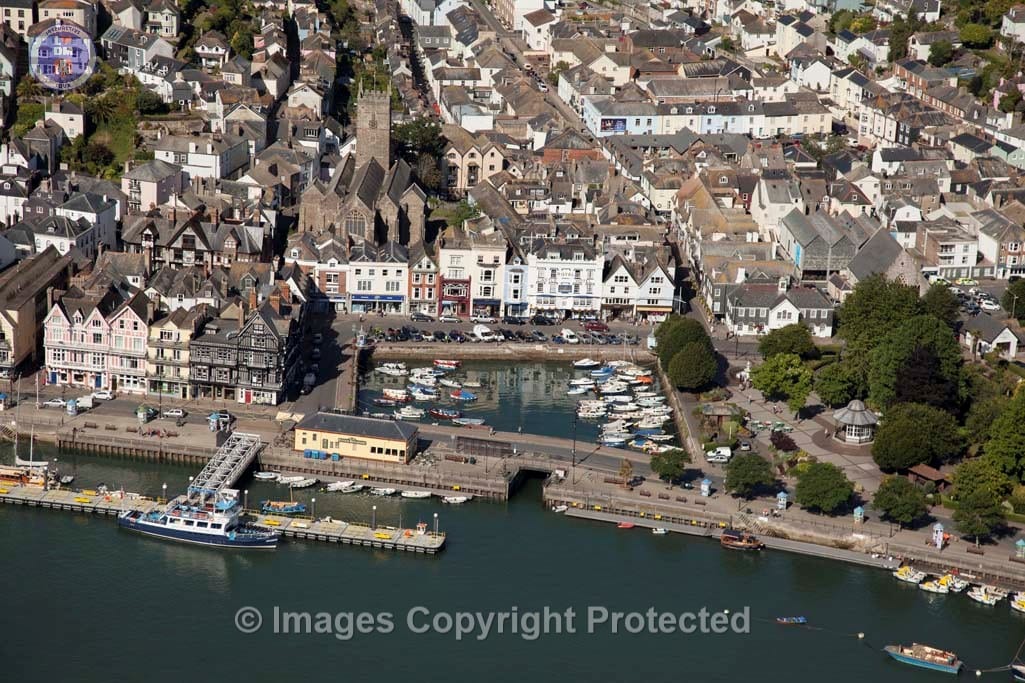
An Aerial View of Dartmouth Boatfloat, Royal Avenue Gardens and the North Embankment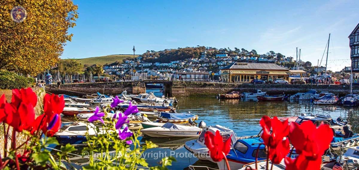
Dartmouth Boatfloat_Late Summer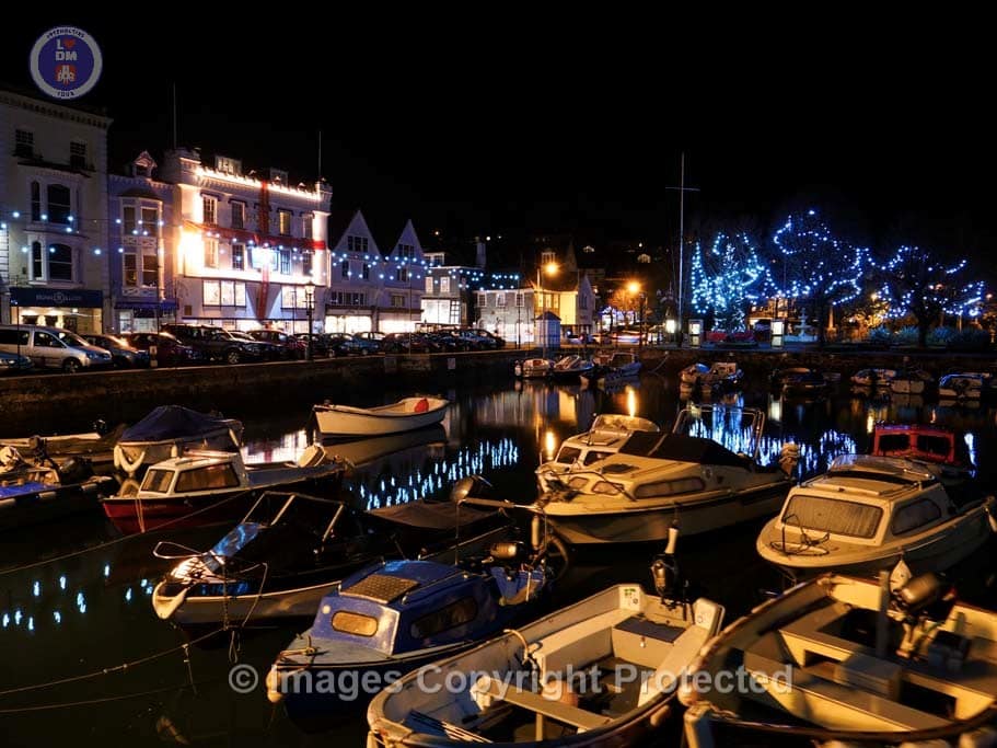
Dartmouth Boatfloat with Christmas reflections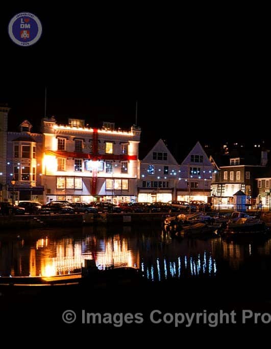
Royal Castle Hotel and reflections of water in the Boatfloat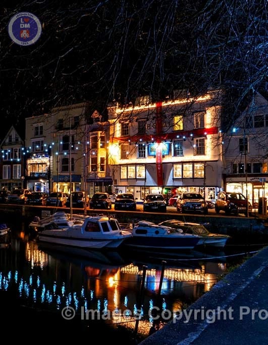
Dartmouth Boatfloat & The Royal Castle Hotel |
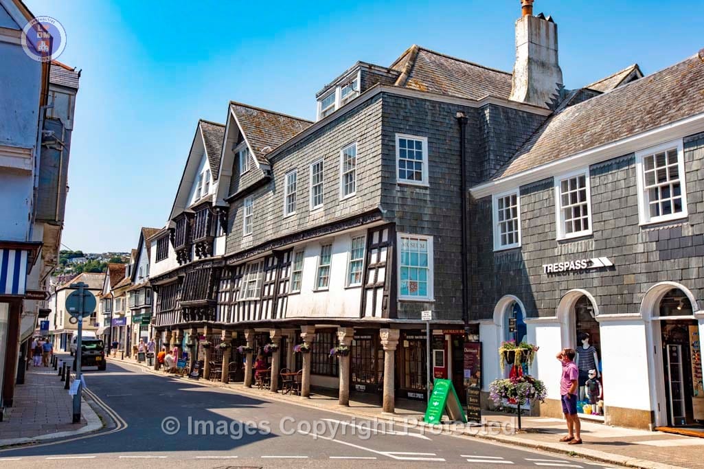
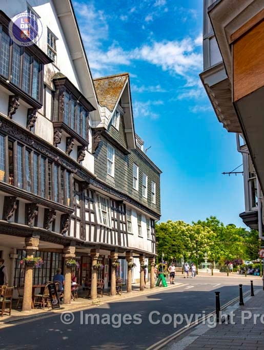
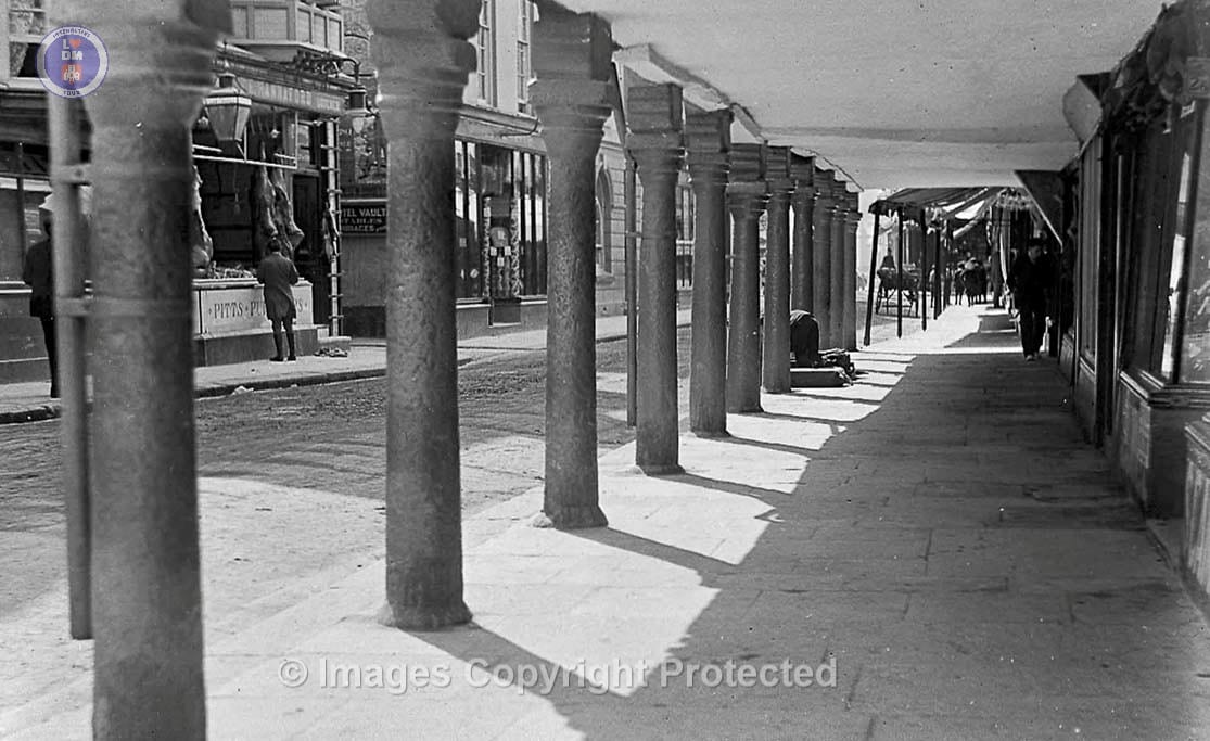
11. The Butterwalk

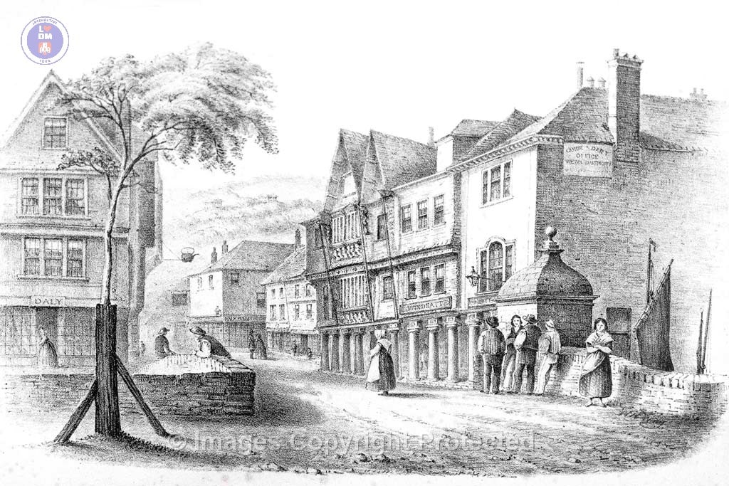
The Butterwalk is a historic row of merchants’ houses built between 1635 and 1640 as part of a larger scheme to create the New Quay, providing merchants with a prime location to oversee their ships and trade. Constructed on reclaimed land, it is notable for its unique timber-framed facades and the colonnaded walkway that gives it its name. The Butterwalk played a significant role in the town’s development as a trading port during the 17th century.
It is one of the finest examples of 17th-century merchants’ houses in England, and a Grade I listed building, with some original features like plasterwork, windows, and panelling still remain.
King Charles II dined in the main reception room of one of the houses, now known as the “King’s Room,” in 1671 and which is situated in Dartmouth Museum. The museum displays a coat of arms and a chair in which the King sat for his extravagant lunch for himself and his entourage.
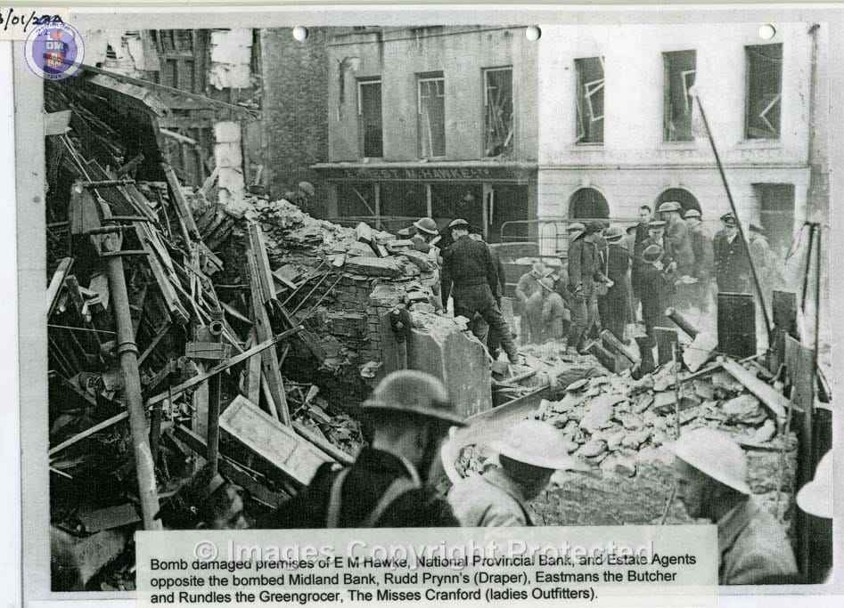
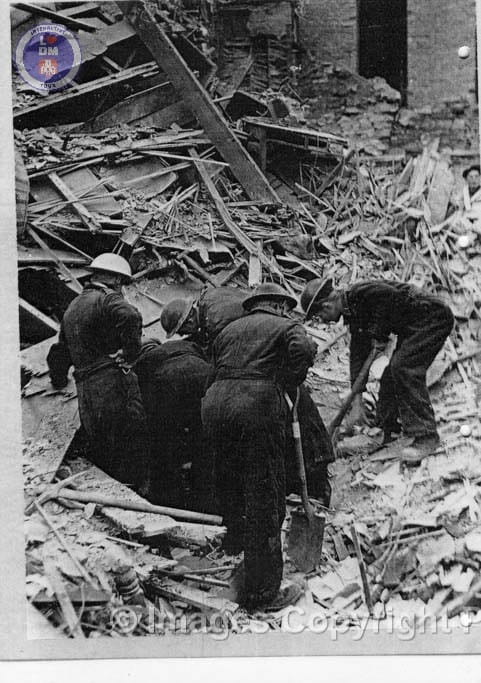
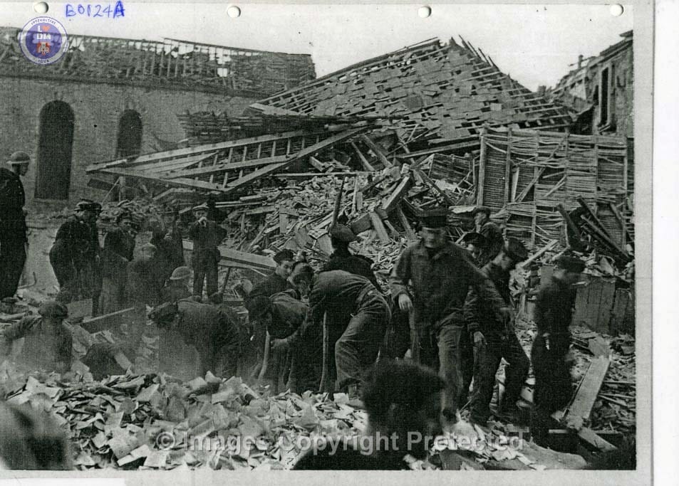
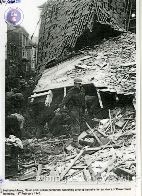
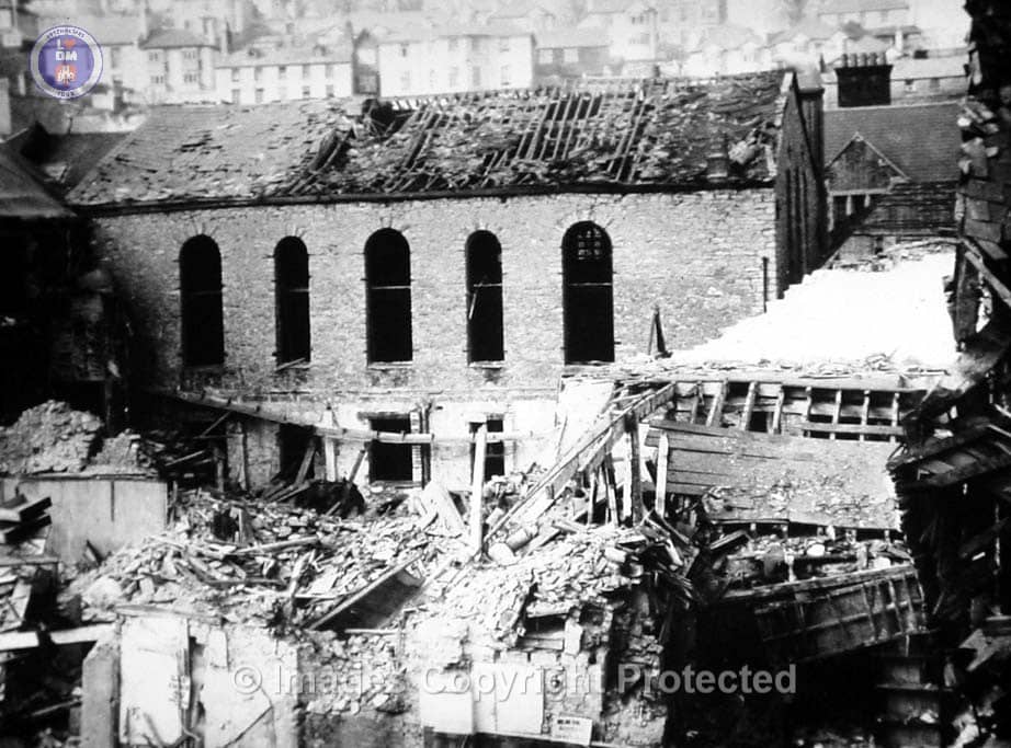
During World War two, the Butterwalk suffered significant bomb damage, initially thought to be severe enough for its demolition. But after careful inspection by structural engineers, it was restored to its former glory in the 1950s, including a major renovation program.
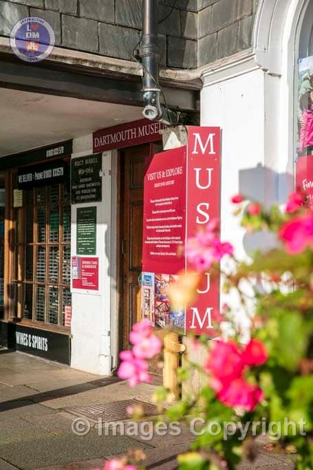
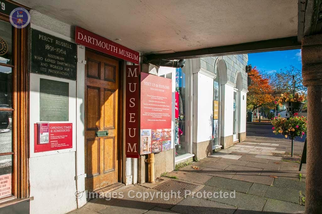
Part of the Butterwalk now houses the Dartmouth Museum, which explores the history of the town and its maritime connections.
The name “Butterwalk” likely comes from the tradition of farmers’ wives selling their produce under the colonnaded walkway.
12. Dartmouth Museum

ACKNOWLEDGEMENT
The producers of this Interactive Self-Guided Tour, would like thank Dartmouth Museum for their kind support and use of many of their amazing archive images.
Dartmouth Museum
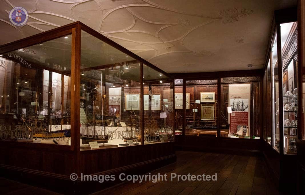
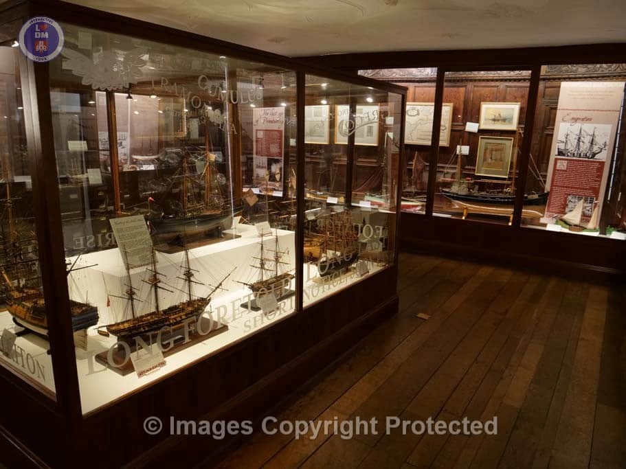
Dartmouth Museum is housed in part of the Butterwalk and this fascinating museum which explores the history of the town and the significant contributions by many famous people and events through history which have influenced the world as we know it today.
The museum is an educational charity and run entirely by volunteers. It is open every day of the year except Christmas Day, Boxing Day and New Year’s Day
Over the last three years, several new exhibitions have been introduced and now include:
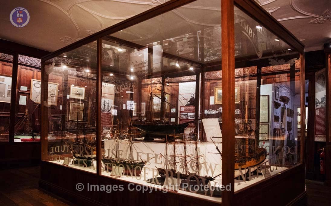
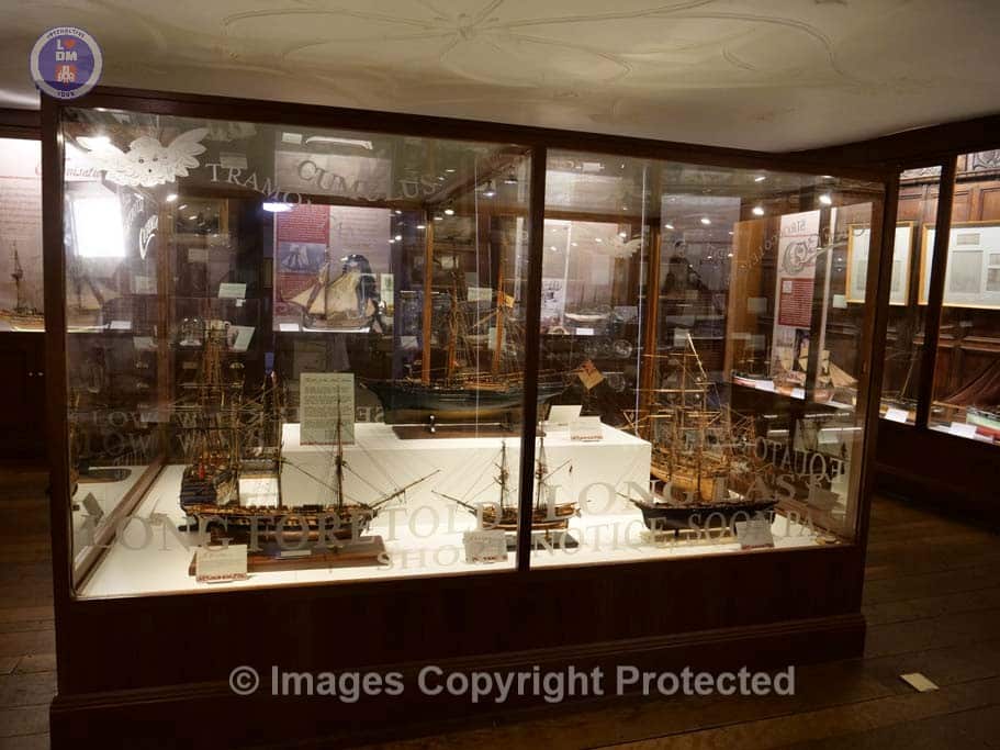
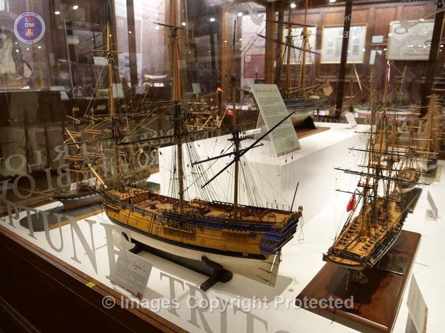
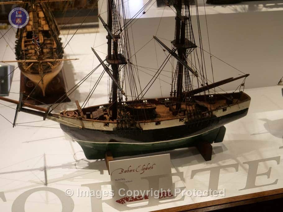
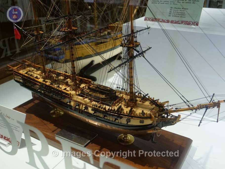
The Maritime History and Heritage of Dartmouth
Our maritime heritage is explored through a wealth of award winning ship models, illustrating the rich history of the port from the departure of 170 ships of the Crusades in 1147 and 1190, through the adventures of the Dart Privateers – Hawley, Raleigh, Gilbert and Davis: plus the Newfoundland cod trade: and shipbuilding up to World War II. This exhibition is situated in the Kings Room, named after King Charles II who dined here in 1671 whilst his yacht ‘Cleveland’ was stormbound.
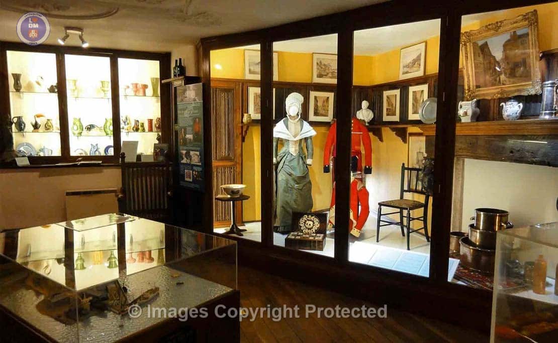
The Social and Geographical Development of the town.
Here we race the social and Geographic history of the town (all the flat land in the town had to be reclaimed from the river) from the stone-age to D-Day. You will find a costume collection, a Sedan Chair, and a wonderful Dolls House with a spooky story about it.
You can also see a selection of Pottery including the Gurgle jugs, from Dartmouth’s famous pottery. There are drawers full of treasures for you to discover.
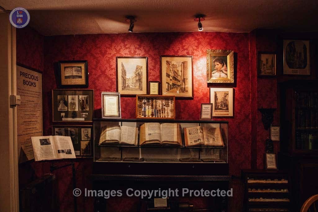
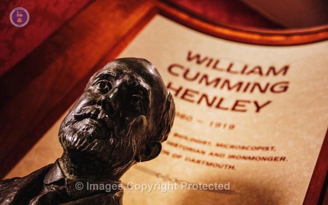
The William Henley Victorian Study
William Henley lived all of his life in Dartmouth and ran an ironmongery in the town. He was self-educated and his thirst for knowledge led him to becoming a talented naturist, artist and scientist. The story of this remarkable manis told through a loving recreation of his Victorian study and the voices of those who loved him. An inspiration for children.
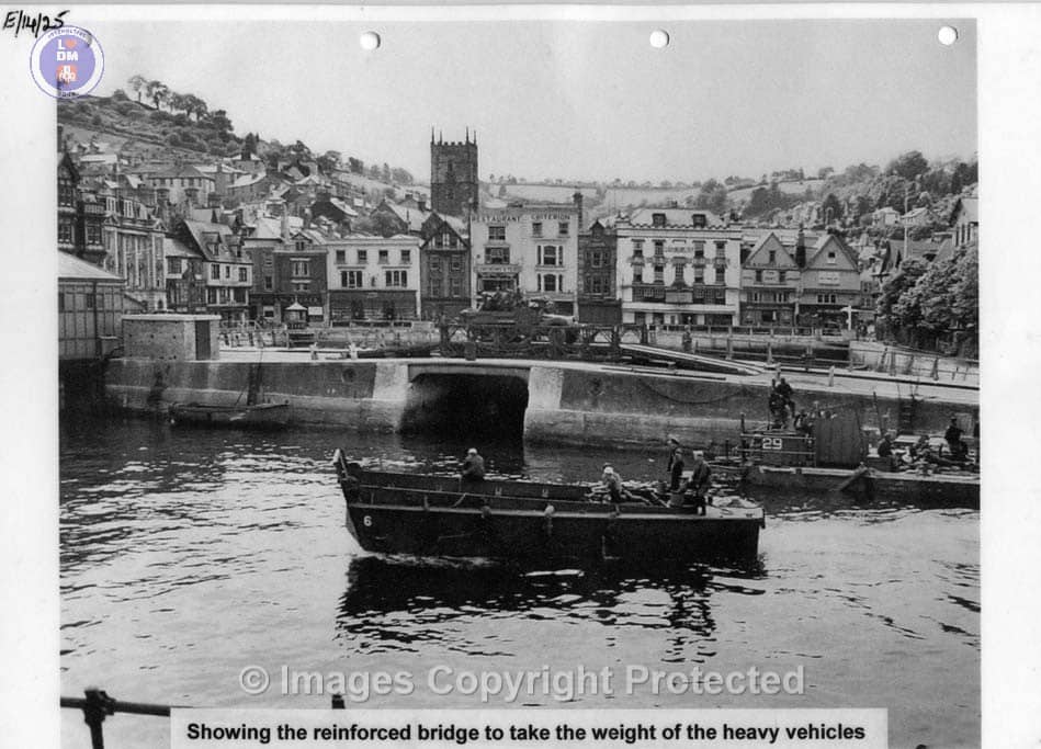
Dartmouth at War
From 1941 Dartmouth was a Coastal Forces HQ, protecting convoys against mines and submarines . A new film tells the story of the 15th Flotilla landing secret agents on the Britanny coast throughout the war. In late 1943, Dartmouth became the Head Quarters for US Troops training for D-Day. Original footage shows the preparations for D-Day and the traumatic evacuation of villages around Slapton. These operations were supported by Wrens whose story is also told.
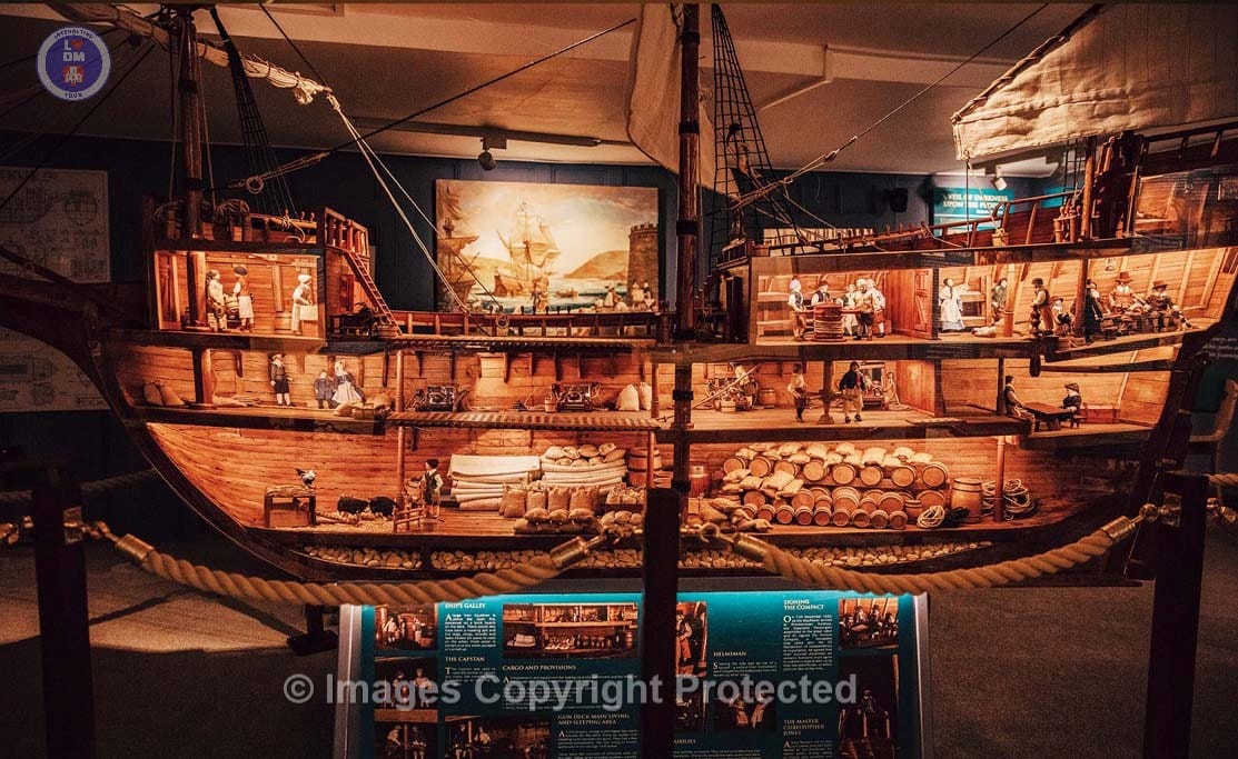
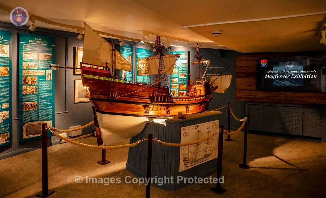
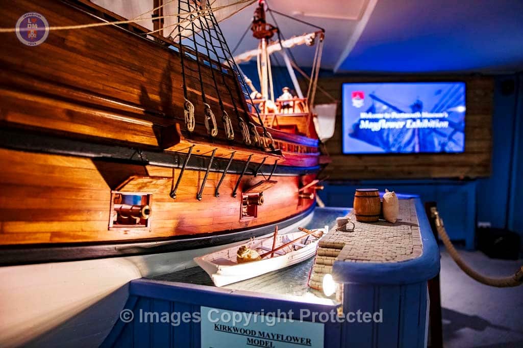
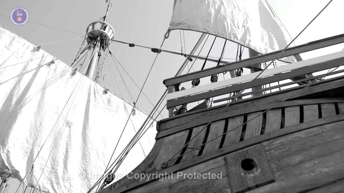
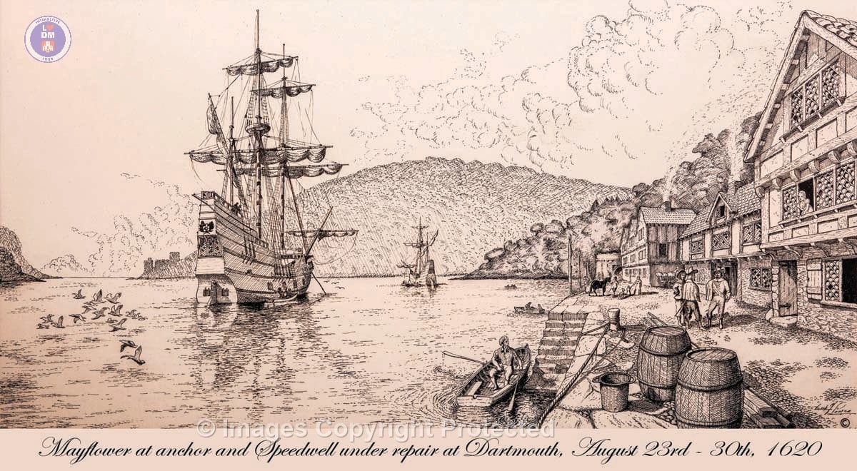
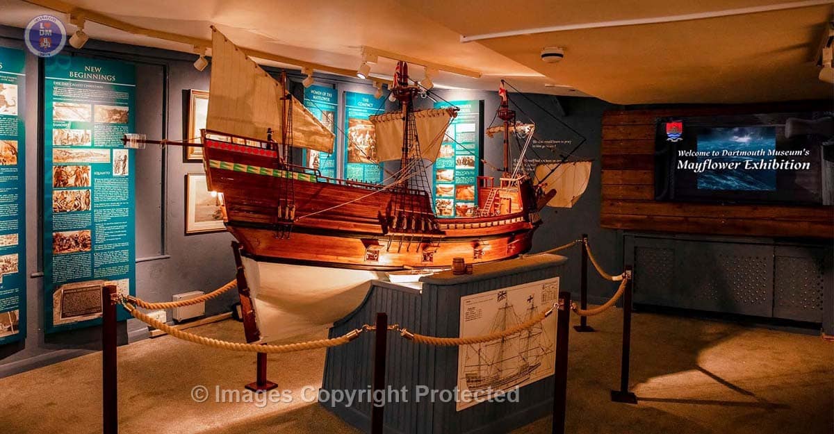
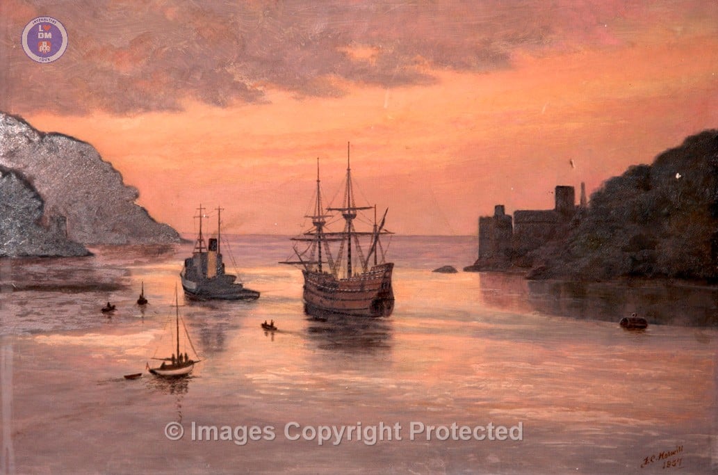
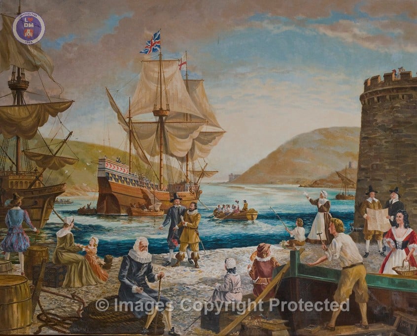
The Mayflower Story
Visit our Mayflower Exhibition with a locally built 12 foot model of thew ship which came into Dartmouth in 1620, open one side to show the contents. We bring to life the disturbing and dark story of the Mayflower Pilgrim separatists, their persecution and suffering, their adventures and search for freedom of worship in the New World and their relationships with and impact upon the Native Americans.
Newcomen and the Engines that changed the World
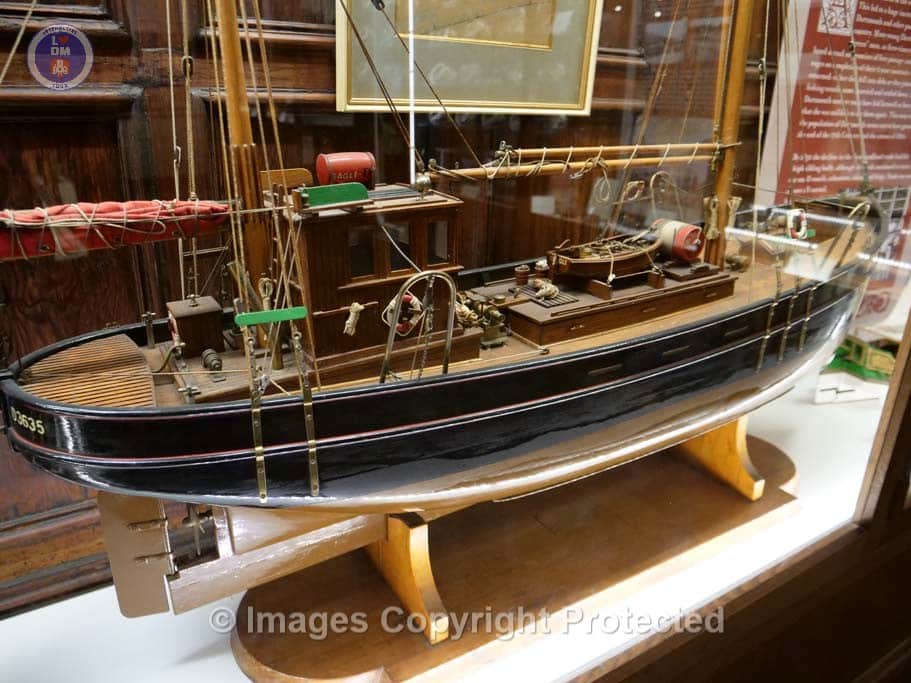
Watch a film about a Dartmouth man Thomas Newcomen’s invention of the atmospheric steam engine. See eight detailed models of the “engines that changed the world”, from Thomas Newcomen to Richard Trevithick. All were designed and build by an internationally renowned model-maker David Hulse, who donated them to Dartmouth Museum.
Legacy of Steam
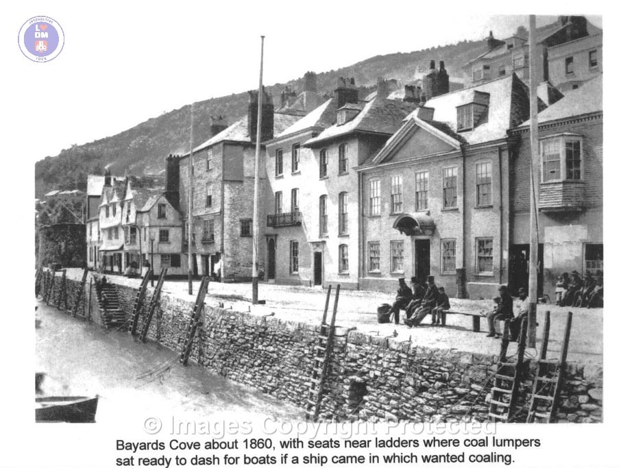
See the impact of steam on Dartmouth: the first Floating Bridge, the Paddle Steamers and the coming of the railway. Read about the hard lives of the Coal Lumpers who shifted the coal that powered the steamships. See the engines invested by Kingdon that powered the luxury motor launches build at Noss Shipyard.
0J7A4504 Dartmouth Museum_LH_ copy
0J7A4530
0J7A3534
0J7A3537
0J7A5868
0J7A5872
0J7A8280_e
0J7A8309_e
0J7A8340
a0520
a0522
b0122

b0122a

B0123A1
B0123A2
b0124a

b01231
b01232
b01241

b01242
butterwalk

DAW
exhibitions
Henley Room
Holdsworth exhibits and collections – Copy
Jesse Room Home page Graphic
Matthew – Mayflower AV Sequence-2
mayflower-drawing-cabinet-panel-final
mayflower-video-placeholder
Museum-Header
P1100181
P1100182
P1100184
P1100190
P1100193
P1100200
Pre D-Day 01
Spivey.1050 – Inner harbour in Dartmouth a (2)
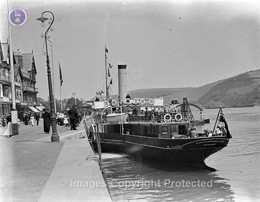
Spivey.1229 – Duke of Devonshire a
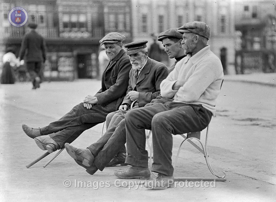
Spivey.1234 – Men on bench a
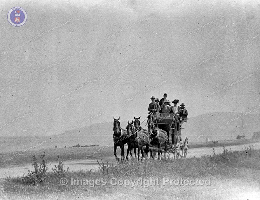
Spivey.1292 – Coach and horses a (2)

Town Stocks
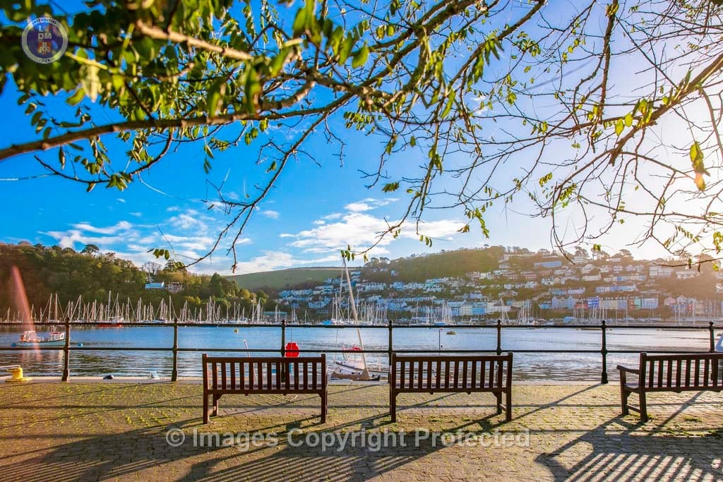
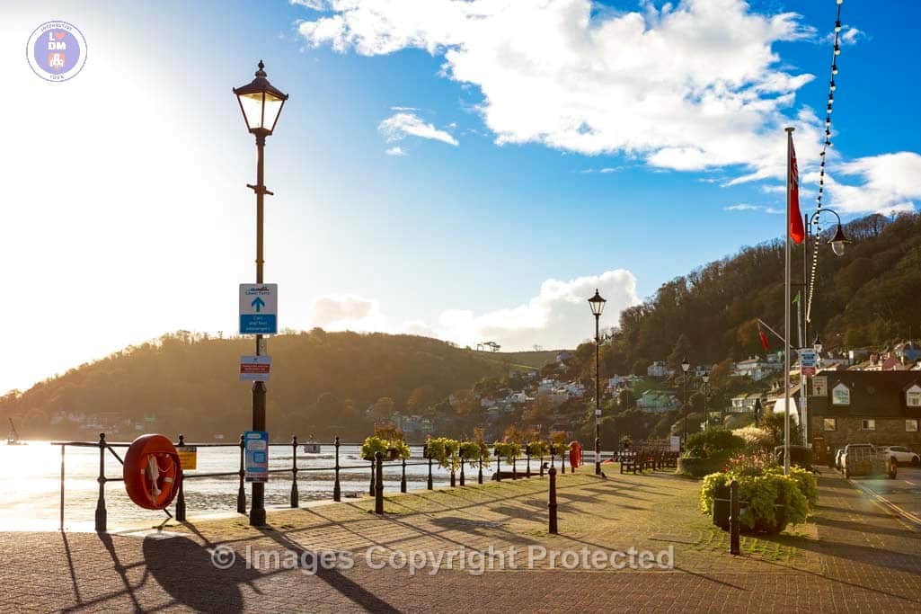
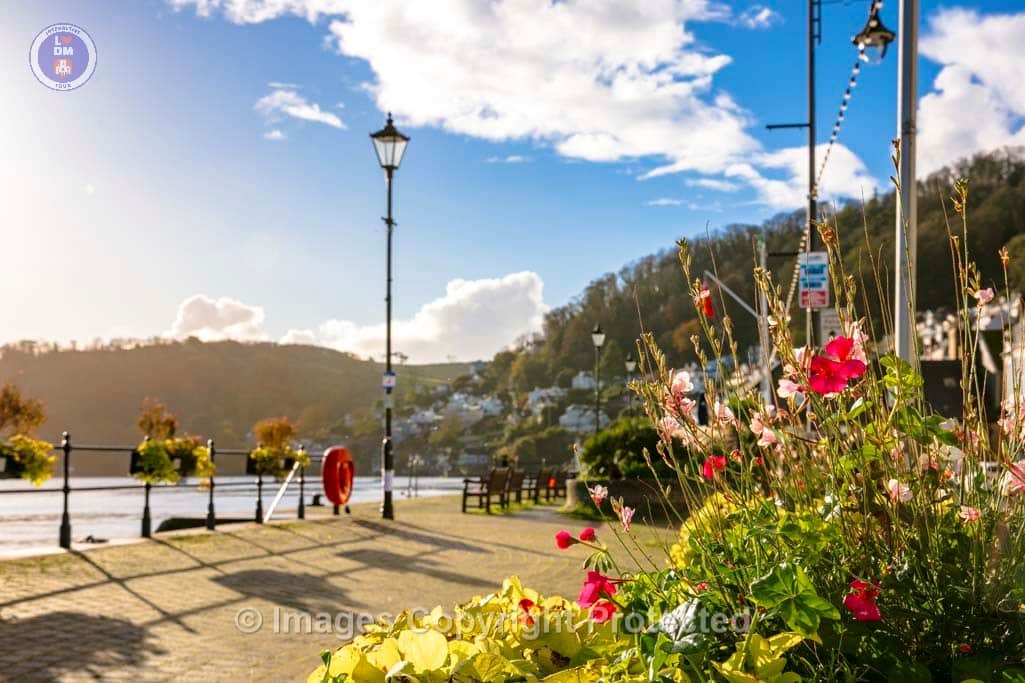
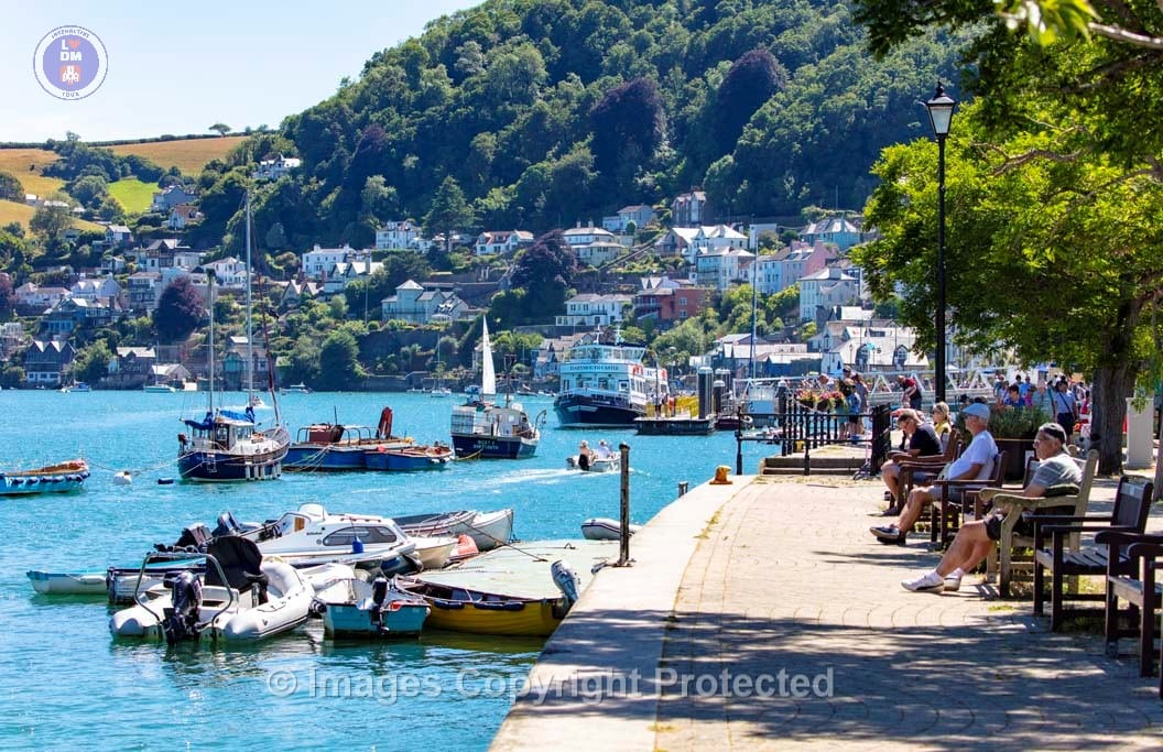
13. South Embankment

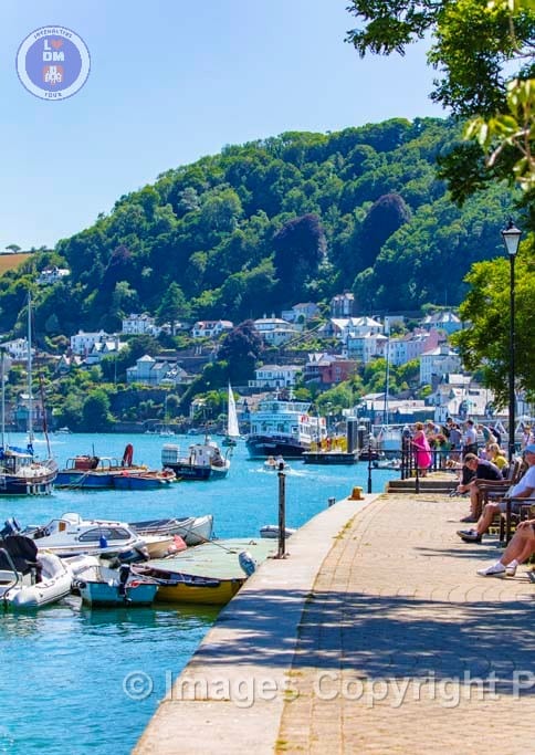
SOUTH EMBANKMENT
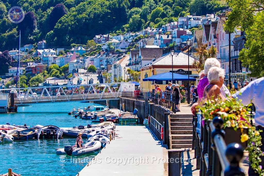
The South Embankment in was constructed in 1885 as a large waterfront development project, aimed to modernize and increase the town’s waterfront need to accommodate larger ships of the Victorian era. The South Embankment was built in conjunction with the North Embankment, from the Lower Ferry Slip to Vavasour’s Slip.
As part of this new development, a new railway station and a new jetty was constructed to facilitate passengers and freight coming in and out of Dartmouth.
The reclaimed land extends the New Ground which is gradually developed as gardens and open space, and the Quay is enclosed to create the Boat Float for small boats. New sites are created for shops, houses and other buildings.
14. Historic Lower Ferry

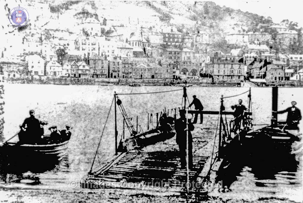
LOWER FERRY
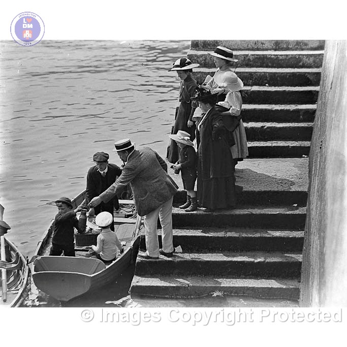
The Lower Ferry has a long history, with the earliest records dating back to 1365. It is the oldest ferry in the area, with the Higher Ferry which started operating in 1831. The Lower Ferry has played a vital role in connecting Dartmouth and Kingswear for centuries, initially operating as a rowing boat moving horses, cattle and Carts, later this evolved into a steam driven ferry.
Here are some key dates of the evolution of the Ferry service:
1365: The first recorded mention of a “Kingswear Ferry”.
18th Century: A second ferry started operating from Hoodown on the Kingswear side, according to Wikipedia.
1864: The Hoodown Ferry was discontinued after the opening of the Dartmouth and Torbay Railway.
1867: A steam ferry was introduced to supplement the rowing boat.
1878: A new steam ferry, the Forester, was brought into use.
1915: The rowing boat ceased operation with the introduction of the Relief.
1920s: The railway sold the ferry rights to Dartmouth Corporation.
The ferry is now owned and operated by the South Hams District Council. It is operated by unpowered ferry pontoons, carrying up to 8 cars each. Each ferry pontoon is pushed and pulled by a tug boat and, when traffic demands, two such ferry/tug combinations are used in service at the same time.[
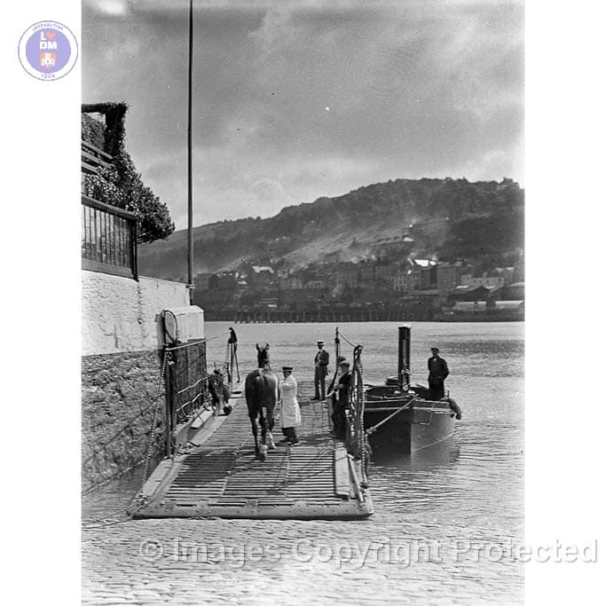
Lower Ferry Dartmouth Side
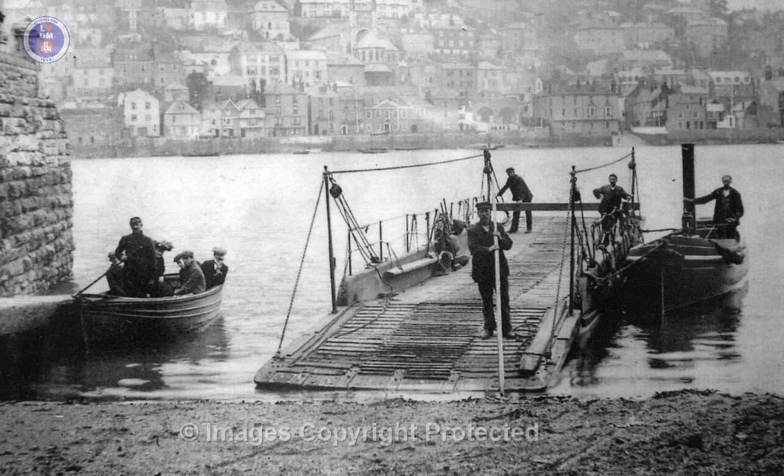
Early Steam Powered Lower Ferry
Early Steam Powered Lower Ferry
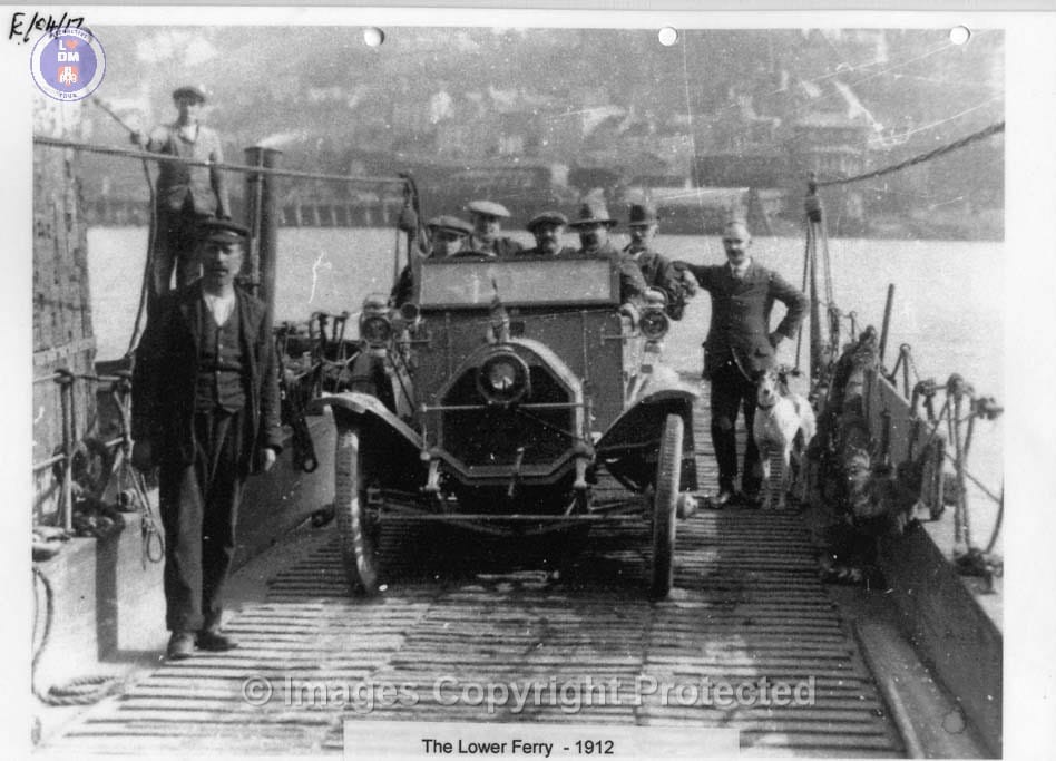
Lower Ferry Circa 1912
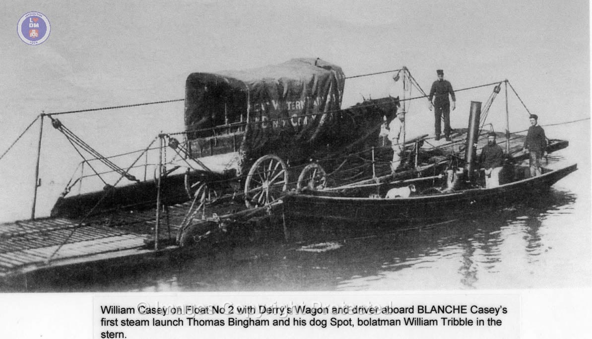
Early Steam Powered Lower Ferry
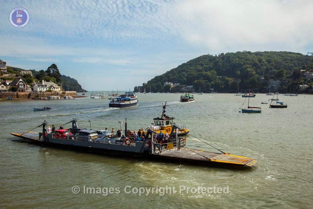
Dartmouth Historic Lower Ferry
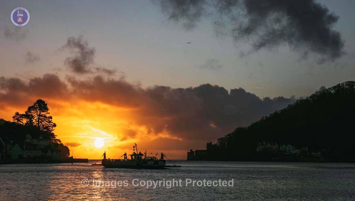
Early Start_Dartmouth Historic Lower Ferry as dawn breaks in winter
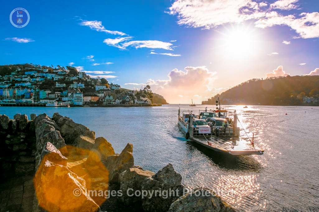
Dartmouth Historic Lower Ferry
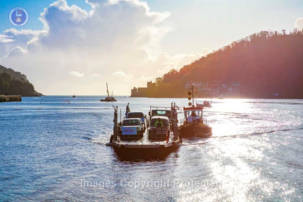
Dartmouth Historic Lower Ferry in bound to Dartmouth Slipway
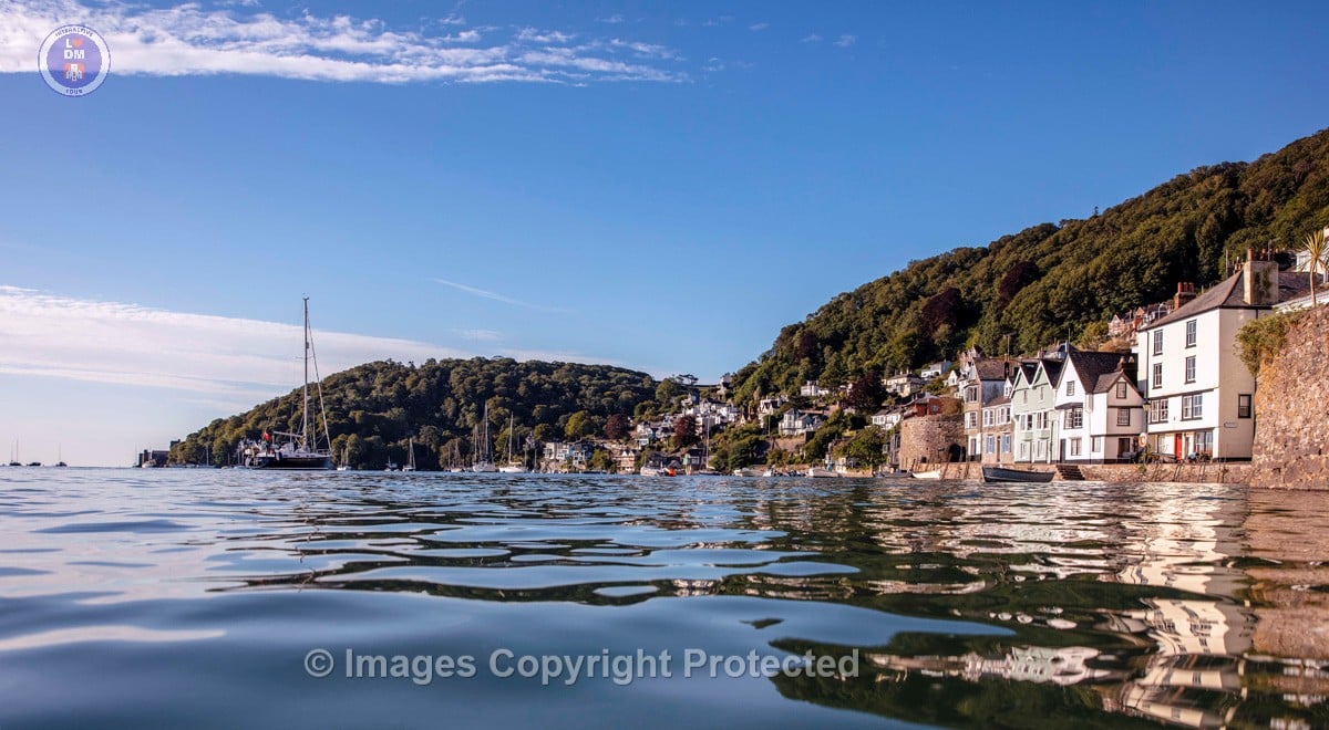
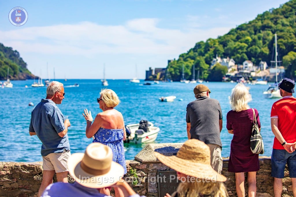
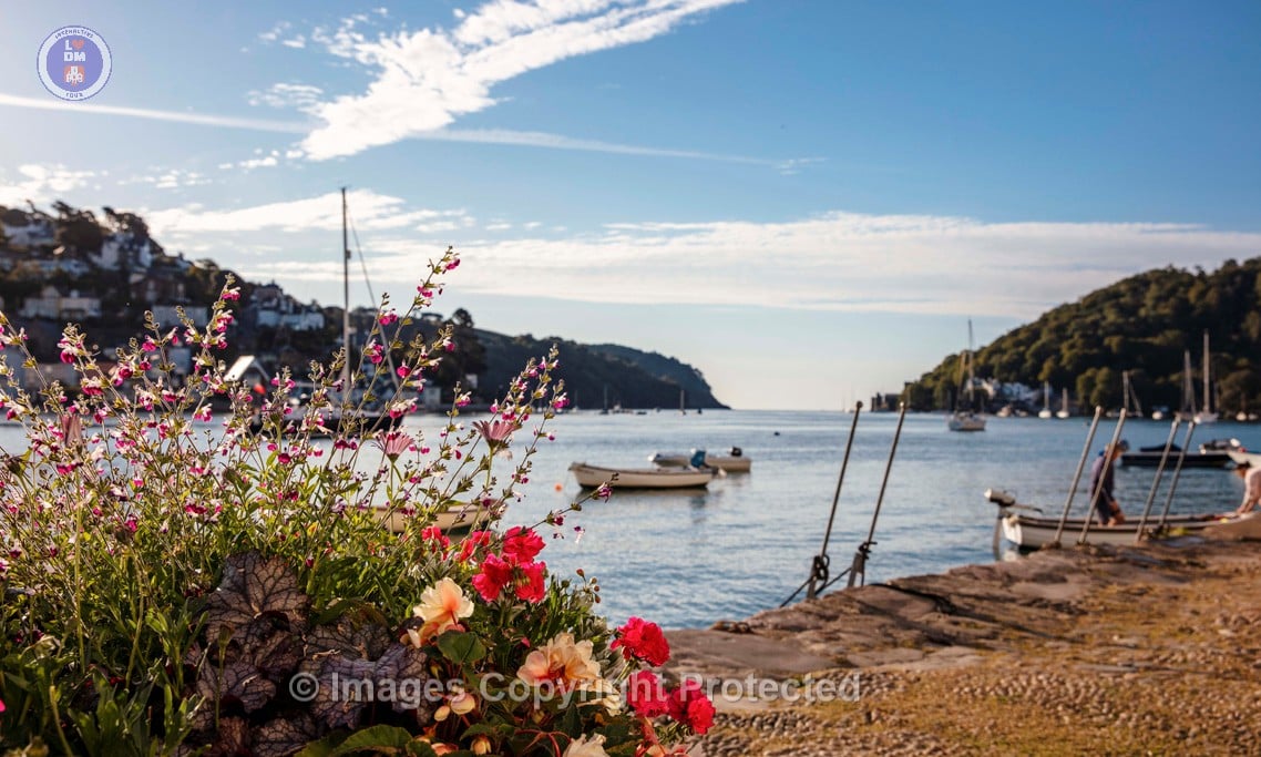
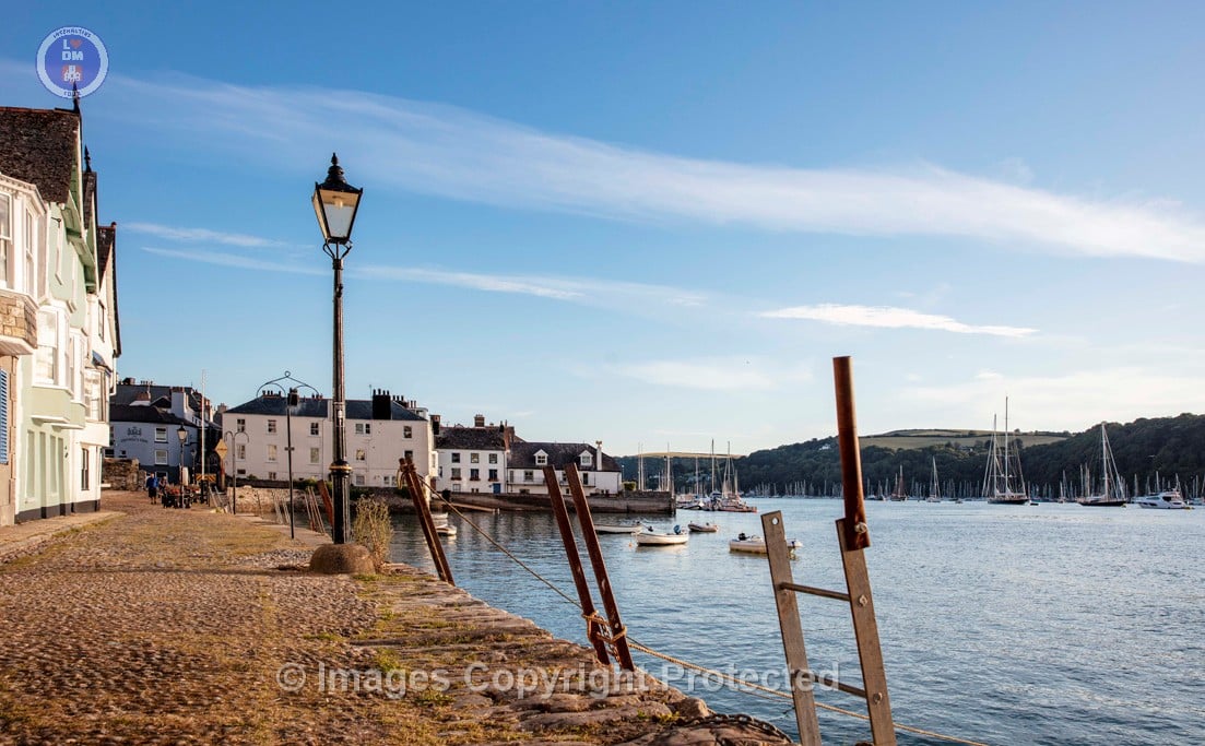
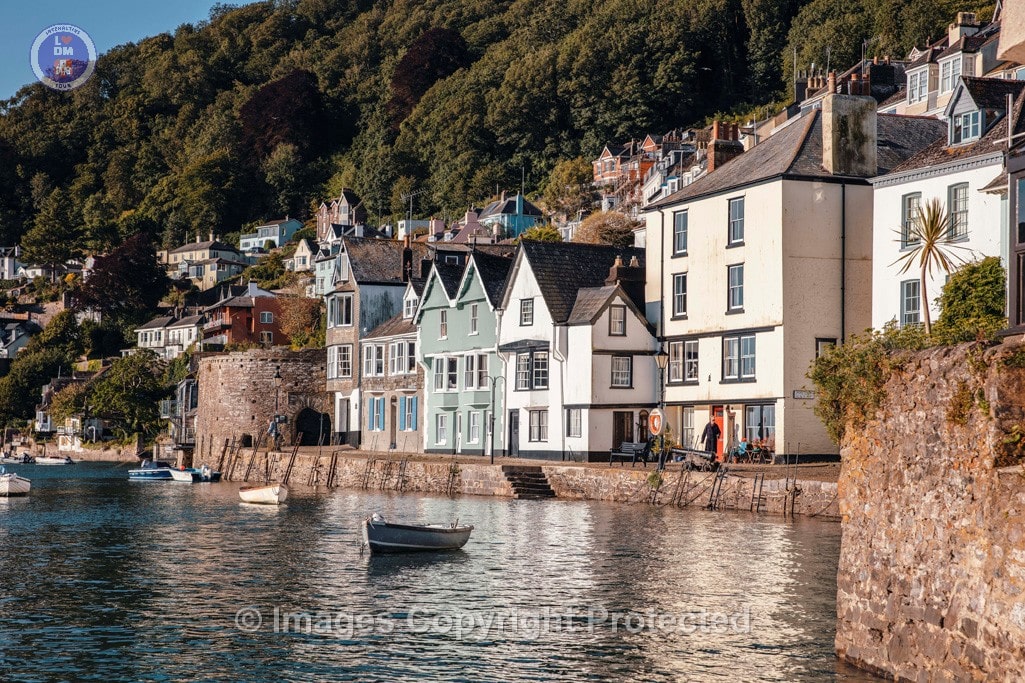
15. Bayards Cove

Bayards Cove
Bayards Cove is one of Dartmouth’s oldest and most picturesque locations, steeped in rich history and architectural beauty. This tour offers provides a details history of the quay, the fort and the significant buildings that grace this remarkable setting. Constructed in the early 16th century, the fort has never been called upon to defend the town, yet it has served various purposes throughout the centuries.
Among the quay’s notable structures, the Custom House and the Morocco House stand out, each with its own fascinating story. The Custom House, once a vital hub for trade and commerce, played an essential role in the town’s economy. Meanwhile, Morocco House is historically significant as it once served as Dartmouth’s first hospital, providing care to those in need in a time when medical resources were scarce. Together, these buildings not only reflect the architectural evolution of Dartmouth but also the resilience and adaptability of its community.
The stories behind the fort’s stone walls and the vibrant life along the quay, make this iconic landmark and its enduring legacy an amazing part of Dartmouth’s history.
OLYMPUS DIGITAL CAMERA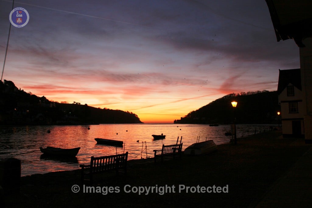
IMG_3269
DEV_DMU_1997_579
DEV_DMU_1997_327
Archives square
OLYMPUS DIGITAL CAMERA
A0103
0J7A3789_e
0J7A3789

0J7A3782 (2)
0J7A3774
0J7A3774 (2)
0J7A3731

0J7A3666
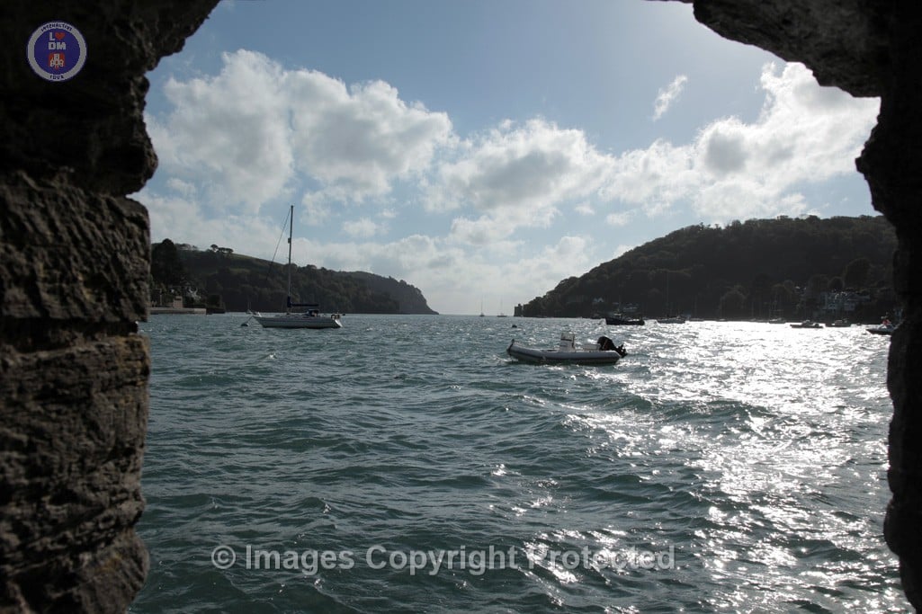
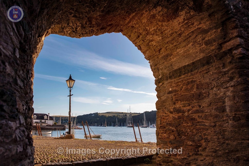
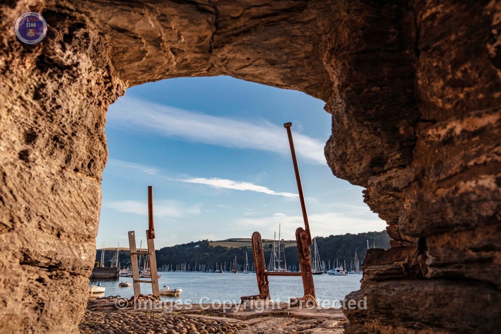
16. Bayards Fort

BAYARDS COVE FORT
Bayard’s Cove Fort, also known historically as Berescove or Bearscore Castle, was an English 16th-century artillery blockhouse, built to defend the harbour entrance at Dartmouth.
Constructed in the early part of the century, it had eleven gunports for heavy artillery and was intended to engage enemy vessels that broke past the external defences of the Dartmouth and Kingswear castles. It remained armed during the English Civil War, but was neglected in the 18th century and used for storage. The fort was restored in the late 19th century and is now managed by English Heritage and open to visitors.
More Detailed History:
It is uncertain precisely when Bayard’s Cove Fort was built: historians suggest that it was either started in 1509–10 at the beginning of Henry VIII’s reign, following a royal instruction to the water bailiff of Dartmouth, or in 1529 by the town in response to fears of a French and Spanish attack. The fort was certainly complete by 1537; Thomas Howard, the Earl of Surrey, may have been referring to it in 1522, when he reported the “blockhouse of stone” in Dartmouth, guarding a well defended harbour, and the antiquarian John Leland described it two decades later as forming “a fair bulwark made of late”.
IMG_1485
0J7A3782
0J7A3759 (2)
0J7A3735

0J7A3731
17. South Town
South Town
South Town in Dartmouth, Devon, evolved from a settlement along the River Dart in the neighbouring parish of Stoke Fleming. It gained prominence as a trading port during the 16th and 17th centuries, with many buildings from that era still standing today. South Town’s history is intertwined with Dartmouth’s larger maritime and trading history, with the town benefiting from the growth of the tourist industry later in the 20th century.
18. Warfleet

Lorem ipsum dolor sit amet, consectetur adipiscing elit, sed do eiusmod tempor incididunt ut labore et dolore magna aliqua. Ut enim ad minim veniam, quis nostrud exercitation ullamco laboris nisi ut aliquip ex ea commodo consequat. Duis aute irure dolor in reprehenderit in voluptate velit esse cillum dolore eu fugiat nulla pariatur. Excepteur sint occaecat cupidatat non proident, sunt in culpa qui officia deserunt mollit anim id est laborum
Lorem ipsum dolor sit amet, consectetur adipiscing elit, sed do eiusmod tempor incididunt ut labore et dolore magna aliqua. Ut enim ad minim veniam, quis nostrud exercitation ullamco laboris nisi ut aliquip ex ea commodo consequat. Duis aute irure dolor in reprehenderit in voluptate velit esse cillum dolore eu fugiat nulla pariatur. Excepteur sint occaecat cupidatat non proident, sunt in culpa qui officia deserunt mollit anim id est laborum
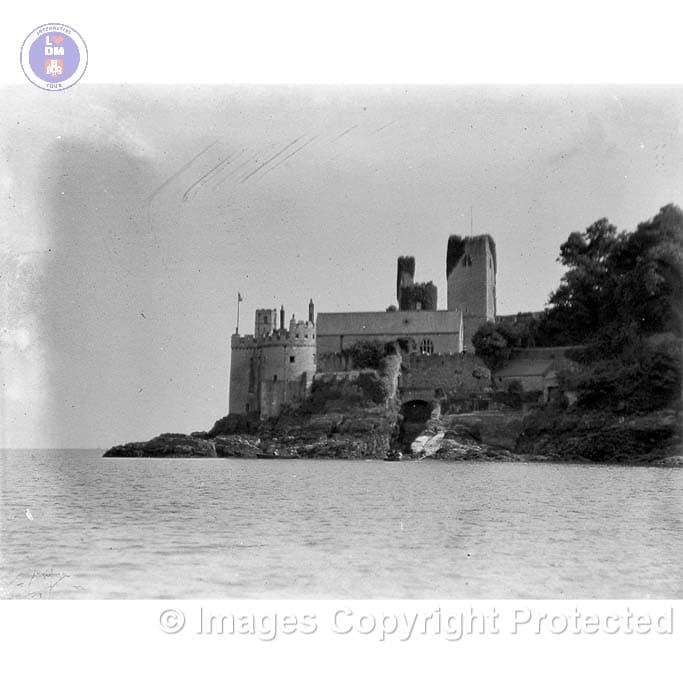
19. Dartmouth Castle

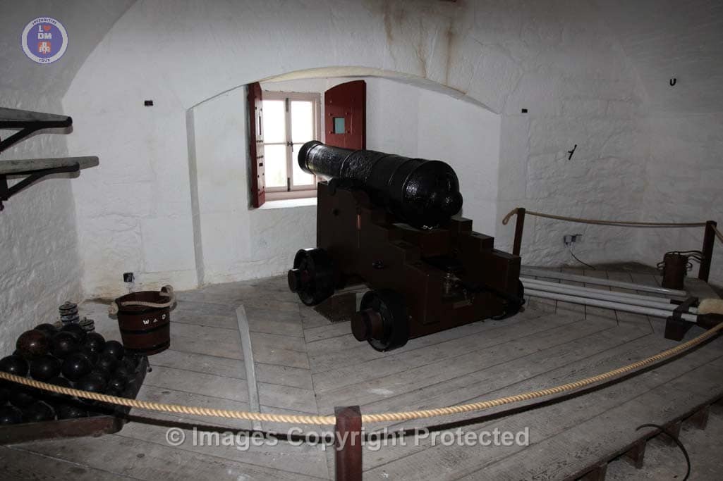
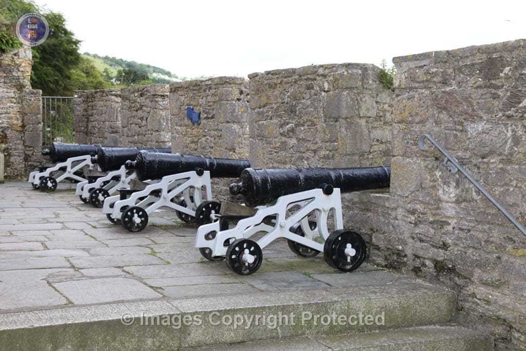
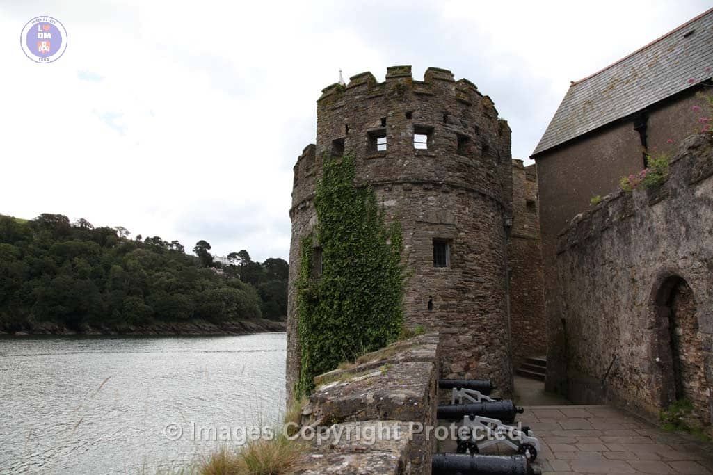
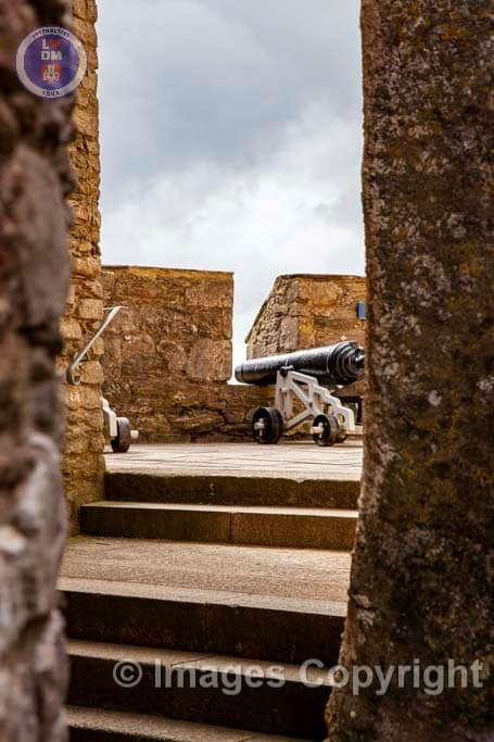
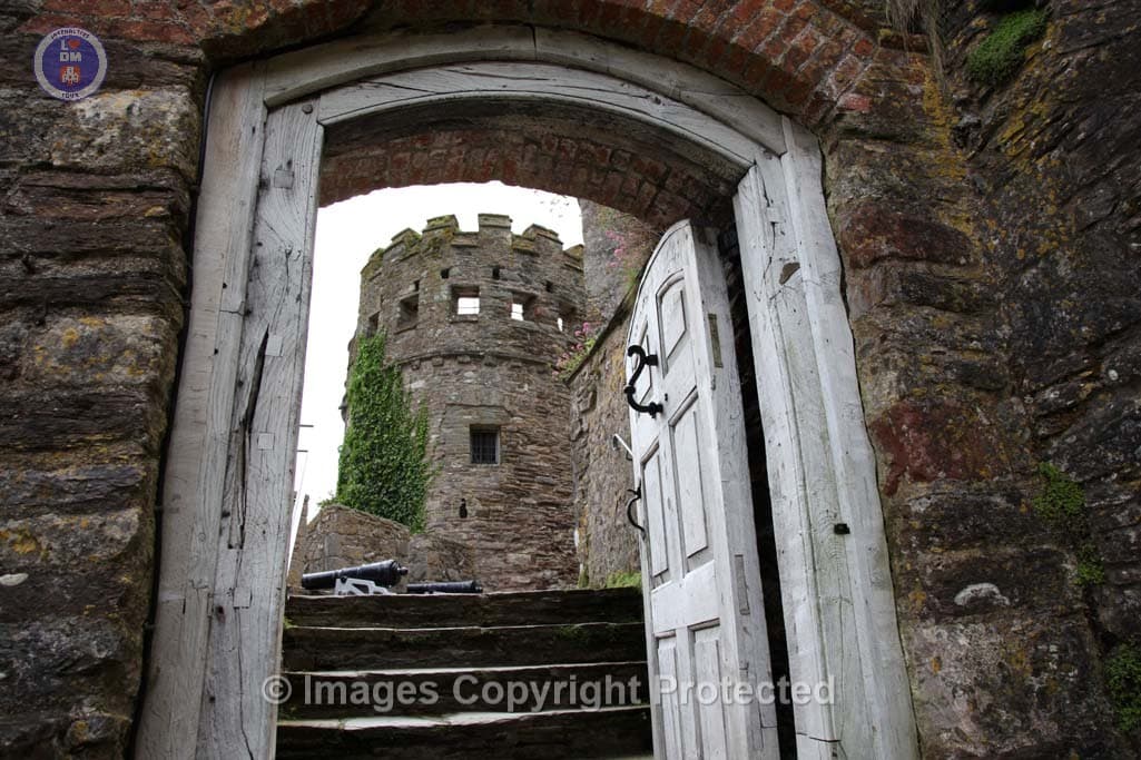
DARTMOUTH CASTLE
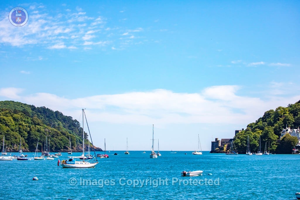
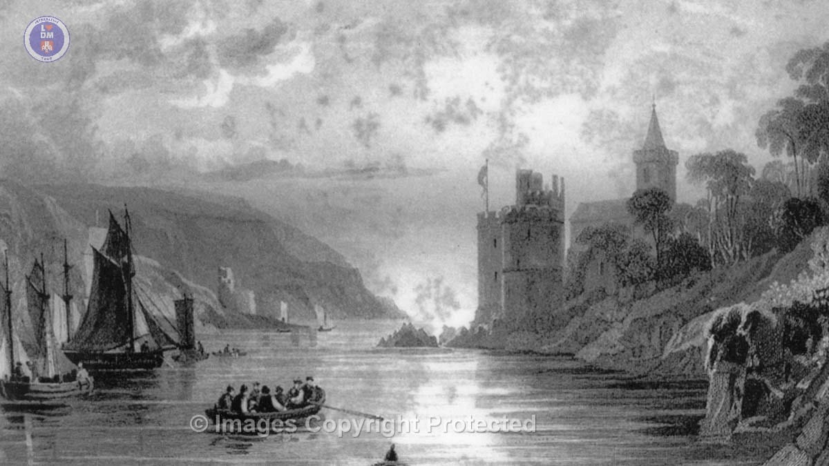
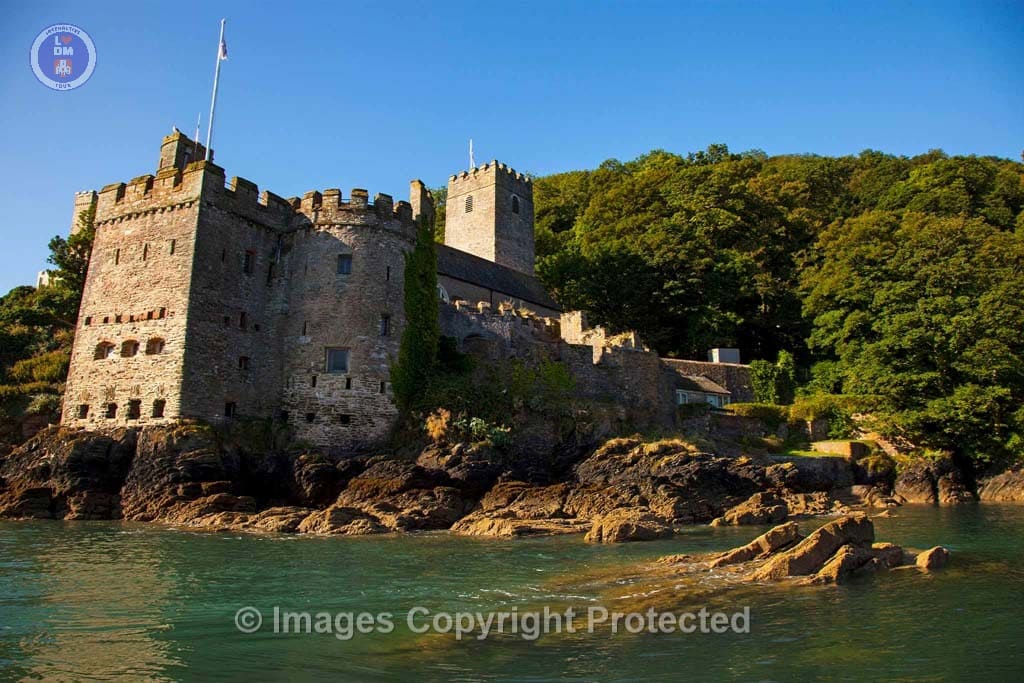
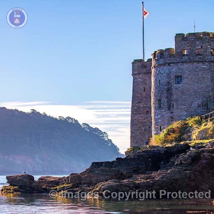
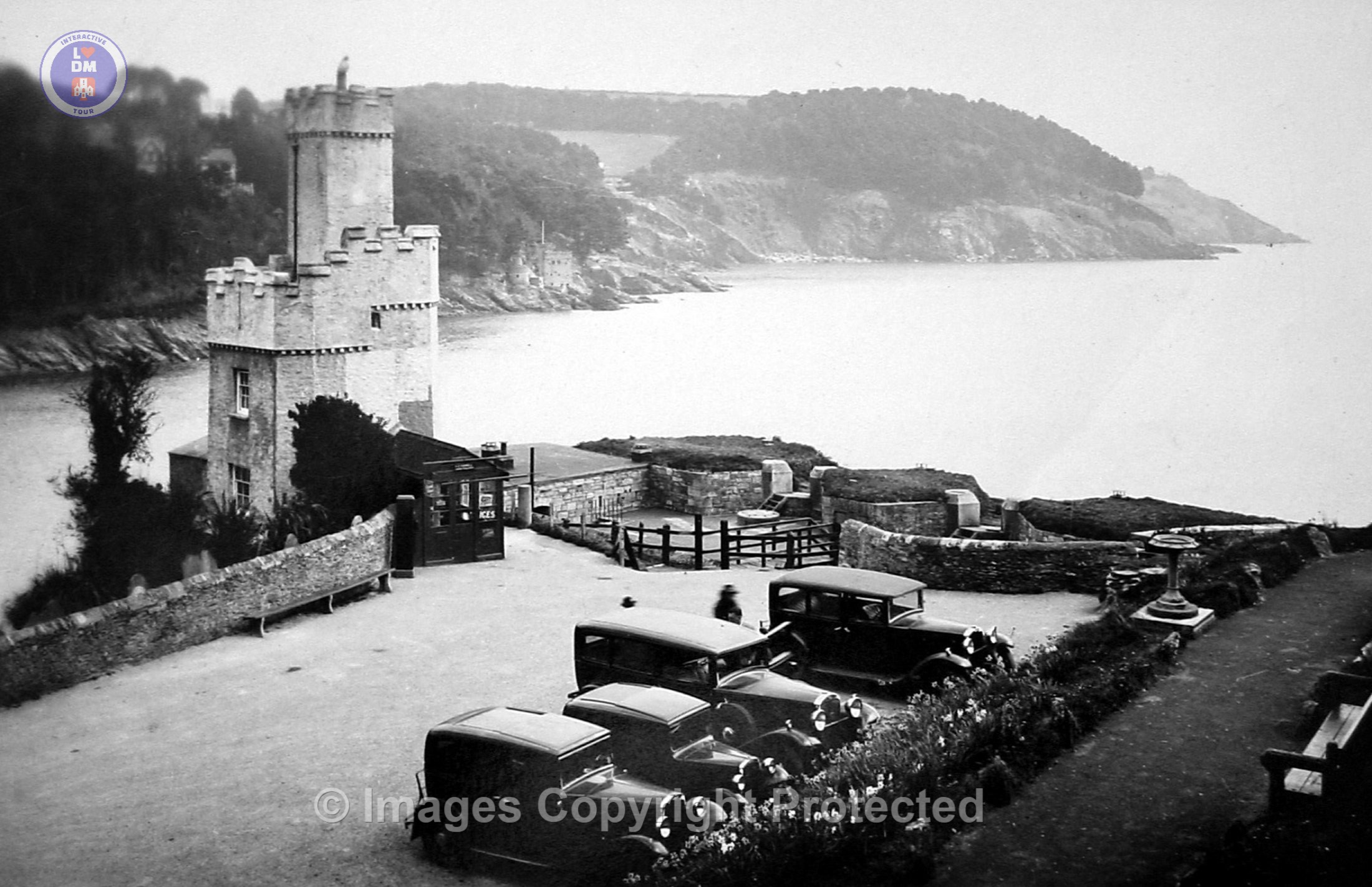
Dartmouth Castle is an artillery fort, built to protect Dartmouth harbour in Devon, England. The earliest parts of the castle date from the 1380s, when, in response to the threat of a French attack, the civic authorities created a small enclosure castle overlooking the mouth of the Dart estuary. This was intended to engage enemy ships with catapults and possibly early cannon, and incorporated the local chapel of Saint Petroc within its walls. At the end of the 15th century, the castle was expanded with an artillery tower and an iron chain which could be stretched across the harbour to a tower at Godmerock; this addition formed the oldest known purpose-built coast artillery fort in Britain. Further gun batteries were added during the French invasion scare of the 1540s.
The castle saw service during the English Civil War of 1642 to 1646, during which its vulnerability to attack from the land became apparent, resulting in the Gallants Bower defensive work above it being used to provide additional protection. In 1748, a new gun position called the Grand Battery was added to the castle, equipped with twelve guns. After years of neglect in the early 19th century, the castle was upgraded in 1859 with modern artillery, but defending the port of Dartmouth was no longer a military priority. By the early years of the 20th century the castle was considered redundant by the authorities, who opened it to visitors. It was brought back into use during the Second World War, but in 1955 it was finally retired from service. In the 21st century, it is managed by English Heritage and the castle received around 40,000 visitors a year.
Cannon Aimed Canons Ready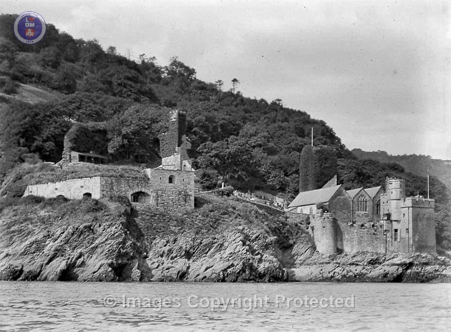
dartcastle-1
Dartmouth Castle From River
Dartmouth Castle
Dartmouth Castle
Dartmouth Castle
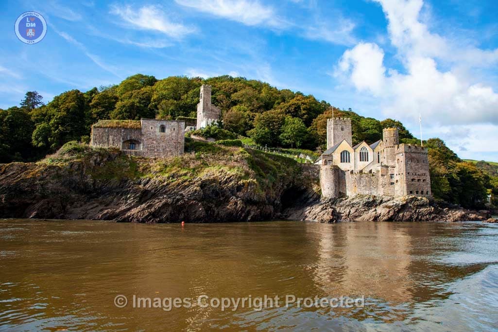
Dartmouth Castle & St. Petrox Church
Dartmouth Castle Longer Range Cannon

Dartmouth Castle

Dartmouth Castle
Dartmouth Castle
Dartmouth Castle Tower
Dartmouth Castle
Dartmouth Castle Tower
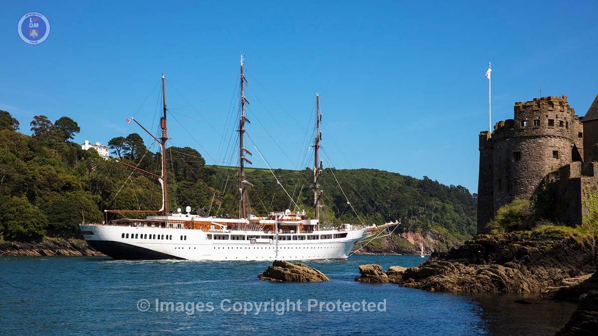
Seacloud II_Leaving The River Dart Passing Dartmouth Castle
20. St.Petrox’s Church

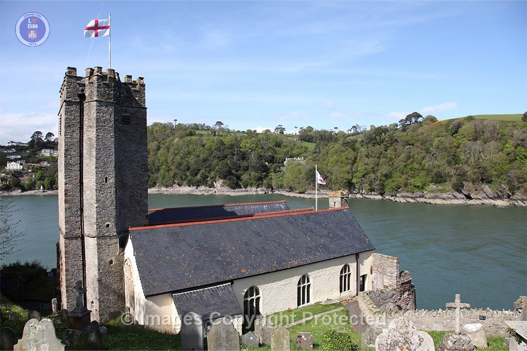
ST.PETROX CHURCH
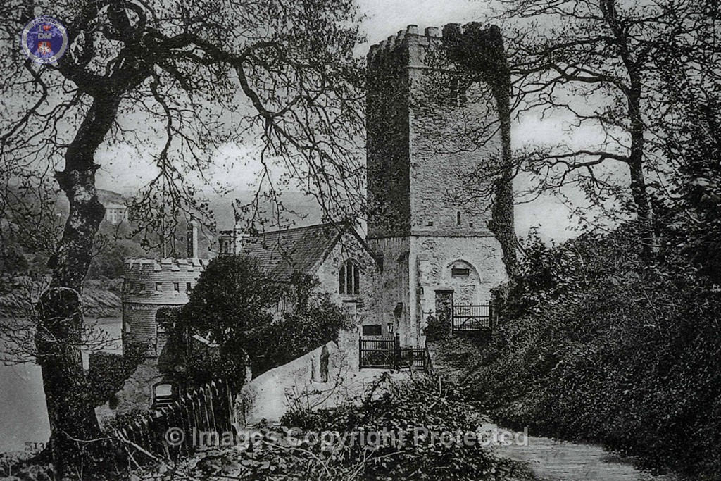
St Petrox Church in Dartmouth is the oldest of the town’s three parish churches, with its earliest record dating back to 1192, with it being dedicated to St. Peter. It is believed to have been a “Monastery of St Peter” at that time, also serving as a light for the harbour to guide ships into the harbour and possibly earning a small income.
The church was rebuilt and enlarged in 1641, as evidenced by a date plaque.
Features of the church
The church features a Norman font, suggesting it has origins dating back to the late 12th century.
There are brass monuments, including one dedicated to John Roope, who died in 1609, and others to Dorothy Rous and Barbara Plumleigh.
This beautiful church and its stunning surroundings make a popular place for marriages and is visited by thousands of visitors each year.
St.Petrox Church
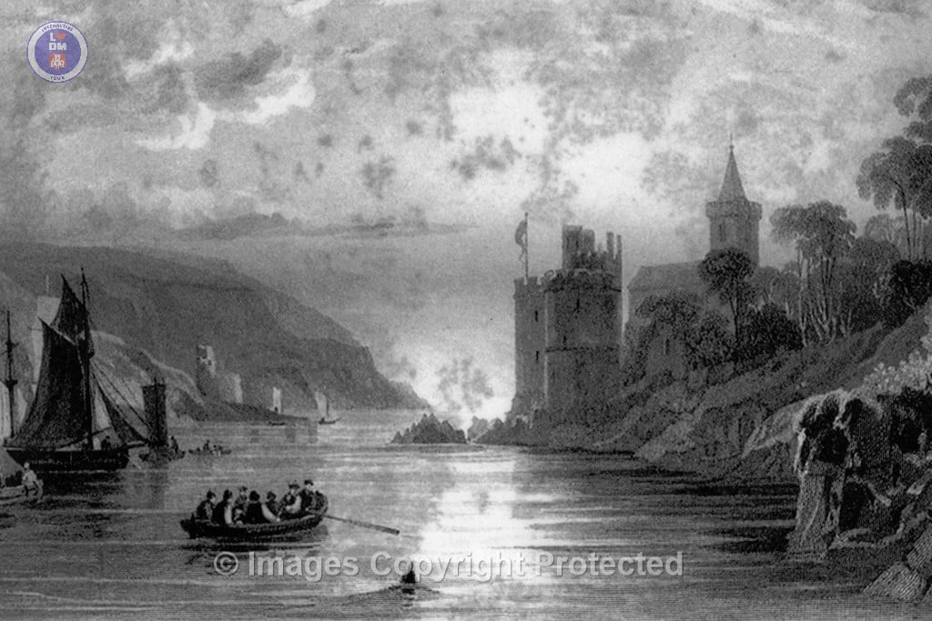
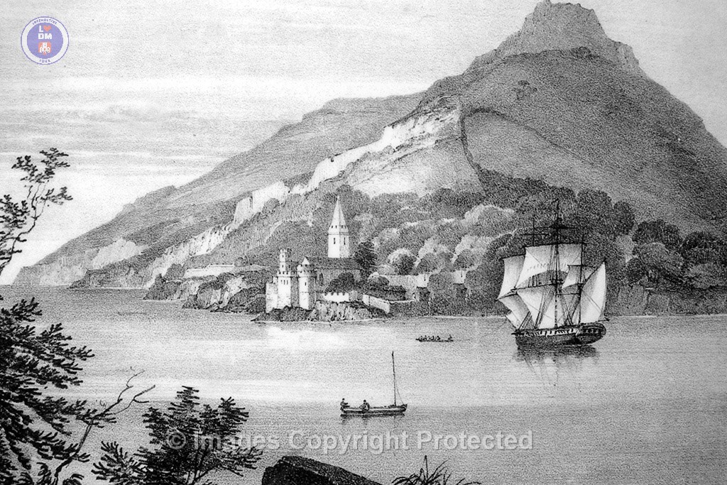
Ancient illustration of entrance to the river Dart, St.Petrox Church and Dartmouth Castle
Car Park and South Entrance to Dartmouth Castle and St.Petrox Grave yard
St.Petrox Church_circa 1870
St.Petrox Church_illustration
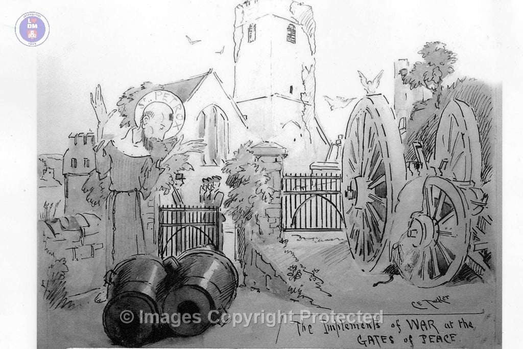
St.Petrox Church_The Implements of War at the Gates of Peace
The Norman Font_St.Petrox Church Dartmouth
21. Gallants Bower

Historical Analysis of Gallants Bower
Gallants Bower, constructed between 1643 and 1645, serves as a poignant example of military architecture during the English Civil War. Erected to defend Dartmouth and its castle from the incursions of Oliver Cromwell’s Parliamentary army, its design illustrates the tactical responses of Royalist forces to the evolving methods of warfare in the 17th century.
Strategic Importance
The fort’s location on the eastern end of a steep spur above the mouth of the River Dart was purposefully selected for its strategic advantages. This vantage point afforded defenders open views of the southern, eastern, and northern approaches, critical for early detection of enemy movements. Such geographic considerations were essential during a time when the element of surprise could heavily influence the outcome of engagements.
Construction Features
The fortification was primarily constructed using earthworks, comprising banks and ditches linked by trenches, which reflected contemporary military engineering principles. The use of stone revetting provided additional structural support, enhancing the fort’s resilience against artillery fire, which became increasingly prevalent during the Civil War. The timber palisade atop the earthen banks was a common defensive feature, designed to delay enemy assaults and protect soldiers from direct confrontation.
The Siege and Its Aftermath
The vulnerability of Gallants Bower became evident during the January 1646 attack led by Parliamentarian General Sir Thomas Fairfax. Despite its formidable construction, the earthwork defenses could not withstand a sustained assault, culminating in the swift surrender of approximately 1,000 Royalist defenders. This event underscores not only the limitations of earthen fortifications against determined attack but also the strategic acumen of Fairfax’s forces, who capitalized on their superior numbers and organization.
Post-War Disposition
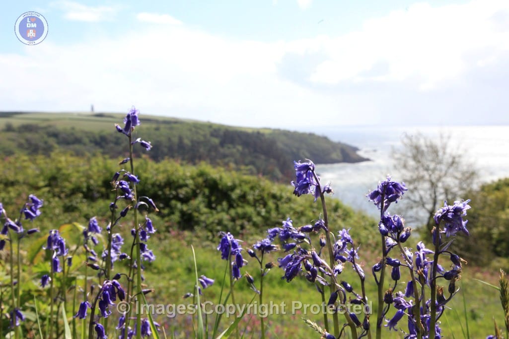
Following the fort’s dismantling in 1650 to prevent its future military use, there was a purposeful shift in the landscape. The natural reclamation of the site, with trees growing on the slopes, symbolically marks the transition from war to peace. This transformation obscured the once-vibrant views from Gallants Bower, serving as a metaphor for the disbanded hopes of Royalist forces and the ebbing of military tensions in the region.
Conclusion
Gallants Bower stands as a significant historical artifact, illustrating the military strategies and architectural ingenuity of the English Civil War era. Its construction, intended to safeguard Royalist interests, ultimately led to its downfall, reflecting the dynamic and often tragic nature of civil conflict. The fort’s remnants continue to resonate, offering insights into a tumultuous period in English history marked by shifting allegiances, strategic innovations, and the enduring scars of warfare.
Gallants Bower
IMG_3524

IMG_3513

IMG_3508

IMG_3505

IMG_3498

gallants-bower

gallants-bluebells

Gallants Bower

0J7A8761_e

0J7A8707_e

0J7A8635_e

0J7A8597_e

0J7A8583_e

0J7A8494_e

0J7A8492_e

0J7A8437_e